I flew to Salt Lake City. My bike was waiting, shipped DHL to my parents' house. 24 hours later I was in
MC's 'E' as we fought Wasatch front traffic, en route to Montana.
Lima, Montana is a classic stop for CDT hikers and GDMBR (divide) cyclists. We were about to become divide cyclists ourselves, for a short time. But ours was a different caper. The CDT is a hiking trail, and few cyclists have laid tire to it. Several locals (thanks Greg, Corey and John) were able to give us some clues, but as far as anyone knew, we'd be exploring new terrain as far as mountain bikers are concerned. (Both Mike and I have completed the dirt road GDMBR, and Mike held the record at 16 days for some years).
Part of the motivation for this trip was that the CDT is not currently wilderness for 200+ miles along the MT/ID border, yet new wilderness areas are being proposed. There's also the danger that cyclists may lose access to non-wilderness areas of the CDT. That would be a shame, and our trip just reinforced why. There's some fantastic riding on the CDT.
Day 1 - Lima to Deadman Lake.Ten miles on a dirt road brought us to the Little Sheep Creek trailhead. Our overall goal was to head west and north on the CDT, to Chief Joseph Pass. This trail took us east and south, but also straight to the CDT. More to the point, we had beta that the trail was a good climb.
Hard to pass up on known good singletrack.
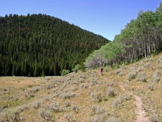
The beta was right on. Rideable trail. Stream crossings. Groves of aspens. And plenty of sage.
A short hike-a-bike led to a confusing sign, which someone had "corrected" using a black pen. We're still not sure exactly which route is the CDT, but we started following CDT signs up a fall-line scar, past a trail-less meadow, finally rewarding us with miles of sweet descending.
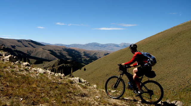
photo by MC
Mike commented that it reminded him of Crested Butte in the early nineties (before it was "discovered" and moto'd out). The area definitely had an undiscovered, raw feel to it, though we'd laugh as we repeatedly hit sections where someone had done twenty feet of supreme trailwork, only to go back to faint or no tread just after.
The best source of info on the CDT is Jonathan Ley's mapset. After Buffalo Spring it noted a ~2 mile section with no trail. An alternate following an unrideable jeep road climb was also given. Mike took to walking the road while I ventured cross country, looking for CDT posts.
I knew where I was going, so I just kept on a climbing contour, passing drainages and gullies. Very friendly XC terrain, but still a bit laborious. Eventually I looked up and saw Mike above and behind me, but he was coasting downhill and following CDT signs. My GPS's basemap didn't line up with reality, so instead of a contouring road to follow to the next saddle, I hiked up a fall line one, rejoining the CDT route.
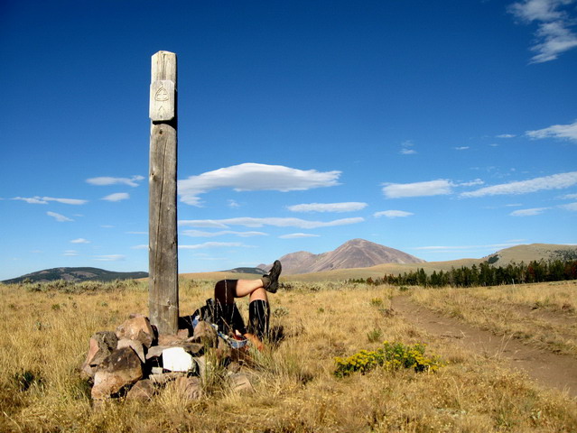
photo by MC
We took a siesta overlooking Bannack Pass, and my allergies caught up to me. Snotty snot, but also hives on the legs. I took occasion to wash them off in the next creek. Something in the sage country doesn't agree with me.
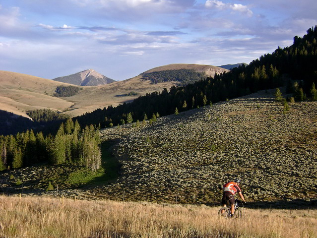
Descending to Bannack was fast, and not bad for a jeep road. But soon it was time to head back up, and there's only one way jeep roads do it on the divide: straight up and straight down.
(It would make a great day loop to ride Little Sheep Creek, then the CDT to Bannack, closing the loop on dirt roads)
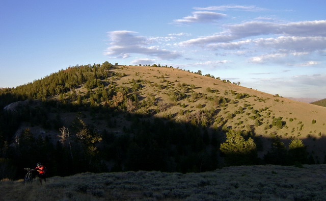
We wished we had taken the alternate to Divide Lake since we were doing the Deadman-Nicholia loop anyway. But we had already pushed up and coasted down too many times. We continued on to Deadman Lake, where Mike saw a sight he couldn't resist.
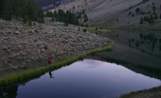
Fish biting like crazy. But daylight was limited, so he was shut out that night. We camped cold by Deadman Lake, and Mike caught several fish early in the morning.
Trail miles - 40
Day 2 - Deadman to Coyote Creek environsContinuing our theme of searching out good singletrack, we sacrificed progress along the route for the Deadman Nicholia loop. We'd seen pictures of this ride, and it's a highly recommended alternate on Ley's maps.
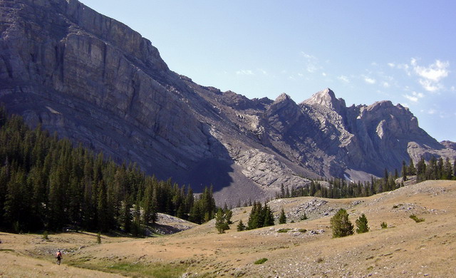
It didn't disappoint.
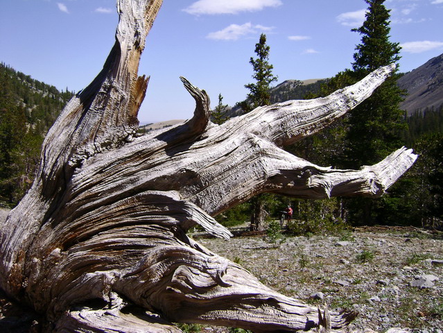

Gradual climbing led us to 9600', and into a moonscape environment.
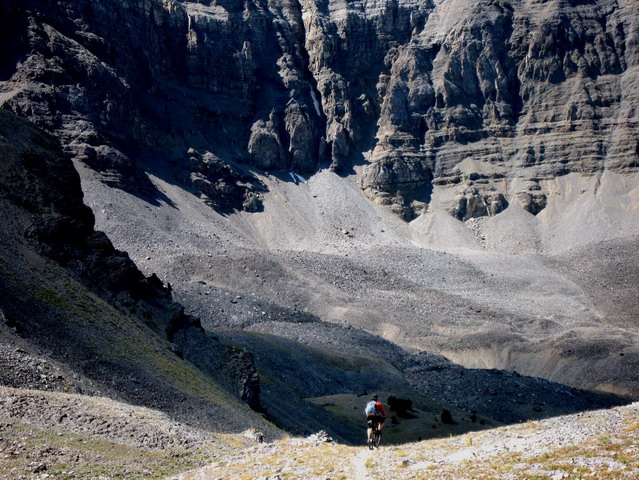
photo by MC
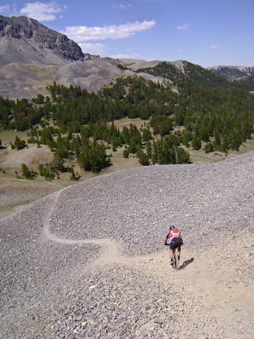
That pile of rock is a funny one. It was impossible to predict or follow the best line. So we both dabbed in several spots, and Mike had a hilarious rolling crash. I don't think I've ever seen Mike crash before, though his roll out of it was so graceful that it almost can't be called a crash.
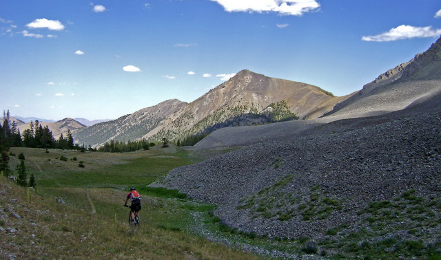
On down the Nicholia drainage, more fun descending ensued, through an areas of recent glacial deposits. I was a little disappointed to ride back into the sage, knowing the allergies they would bring.
Worse, a bee flew between my glasses and face. His immediate reaction was to sting. Mine was to grab the brakes with one hand and flick my sunglasses to the ground with the other. Yeowch! Knowing what happened to my ear on my last bee sting, I worried a little that my cheek my swell my eye shut.
We got distracted by Harkness Lakes. Mike by the biting fish and I by the fisherman's singletrack going 'round the Lake. With neither trail no posts Mike turned to me,
"What do you think?"
"I think I lost the maps."
They'd flown out of my feed bag some miles ago. And now we really needed them. We started following the GPS line, but it was wrong. But keep wandering in the general direction (GPS inspired or otherwise) and you'll eventually spot a CDT post somewhere. This is wide open country, afterall.
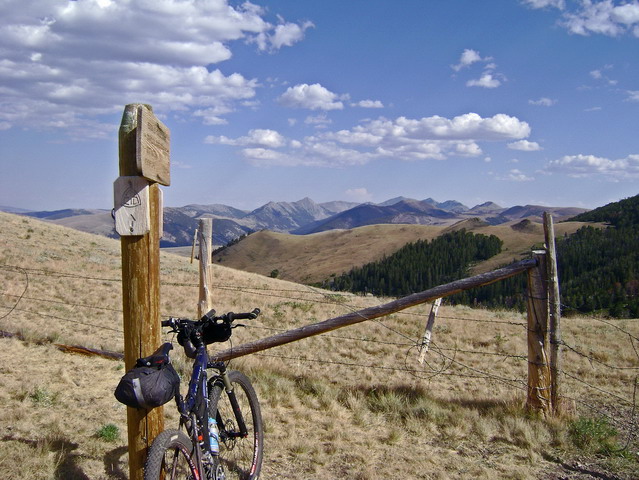
Some vague trail led us to a saddle above Meadow Creek. We both spotted the contouring trail, but stinky trail dropped us fall-line style down to the creek, only to climb in the same regrettable style.
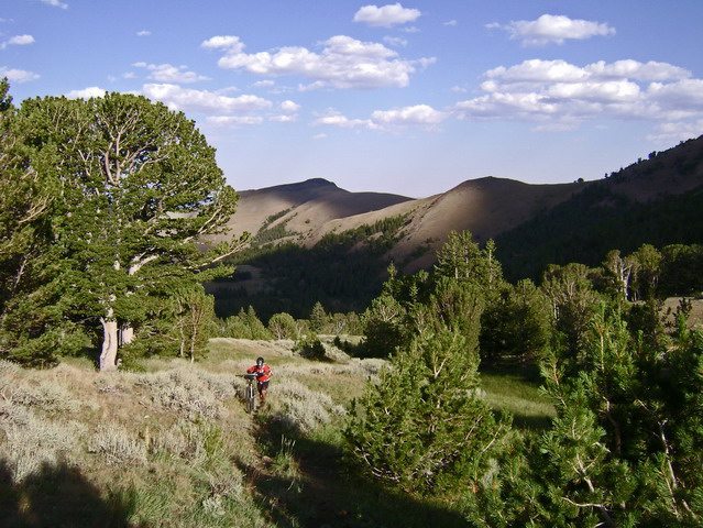
I actually didn't find this section too distasteful. Effort could have been saved on the contour / XC option, but I didn't mind having a trail to follow, especially given how the next miles would unfold.
At the head of Meadow Creek we joined the continental divide and I spied three hikers on their way down. I didn't like the look of their route -- no trail, steep and somewhat rocky.
I caught my breath while Mike and the hikers converged on the pass. It was windy and late in the day, so we didn't converse too much, though we all would have liked to. We exchanged a bit of trail info and were on our way. (We would later meet these hikers back in Lima, learning that they found my lost maps and also that they have a website:
walkingcarrot.com detailing their trip).
A short hike led to open hillsides and overwhelming views.
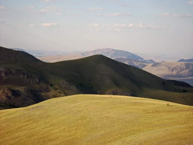
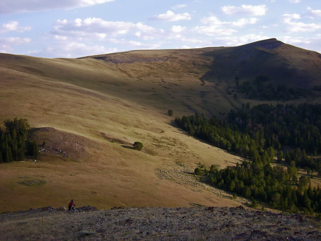
Pretty magical evening to be out on the bike, though the only trail tread was a brief unrideable section through some rocks.
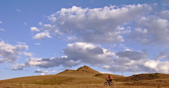
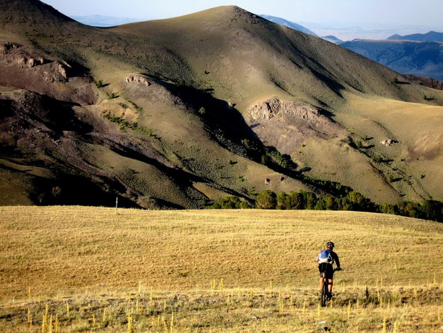
photo by MC
Post to post riding.
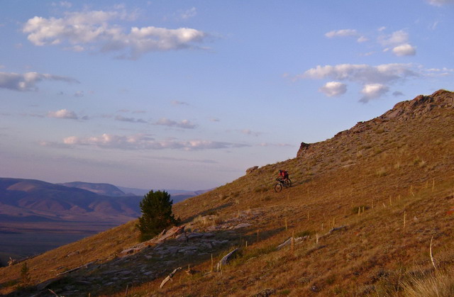
Lack of maps cost us a bit heading to Coyote Creek. I enjoyed the route finding challenges, though, and the lack maps made it all the more mysterious. This section of CDT sure ranks high in the adventure department.
We rejoined good tread in Coyote Creek, where Mike pointed out water but failed to stop. Too excited at the prospect of fun trail, he kept rolling through talus fields, contouring away from Coyote Creek. I pedaled hard to catch him and asked, "why didn't we stop back there?" We were short on both water and daylight.
We backtracked, filtered water, then continued on the fun trail as the sun set. We found a campsite on the side of the trail suitable for two tarps.
Despite being tired, allergies made for a restless night, once again in the sage country.
Trail miles - only 30. Average speed < 4 mph.
Day 3 - Coyote Creek to Bannock Pass, then off the divide to Grant, MT.
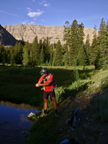
A mishmash of singletrack and jeep roads took us to Tex Creek.
Pleasant 2-tracks continued, bringing us around the Montana side of the divide, in much lower country than the actual divide. We finally caught up to a set of footprints we'd been following for two days. Cicely B started on the Mexico border sometime in the spring, and it looks like she's going to wrap it up. It's hard for me to imagine what it's like to have been on a trail like the CDT for so many months and how it would affect you. She didn't seem to want to chat, so we rolled on and left her to the natural rhythm of her thru-hike.
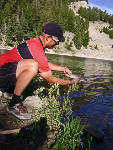
At Morrison Lake Mike caught his big catch of the trip. He'd promised me trout every night to placate my bottomless bit of a stomach (not really). But so far he'd only caught fish in the morning, when neither of us were willing to build a fire and wait to clean/cook one.

North of Morrison Lake the CDT follows a jeep trail, and the best word to describe it is
agonizing. Attaining the divide at 9000', hike-a-bike style, was only a warmup. A hot one at that -- the heat was surprising and after 3 days in the sun, it was beginning to have an effect.
Once we were on the divide our fears of melting in the sun were blasted into oblivion. We'd fight fierce crosswinds the rest of the day.
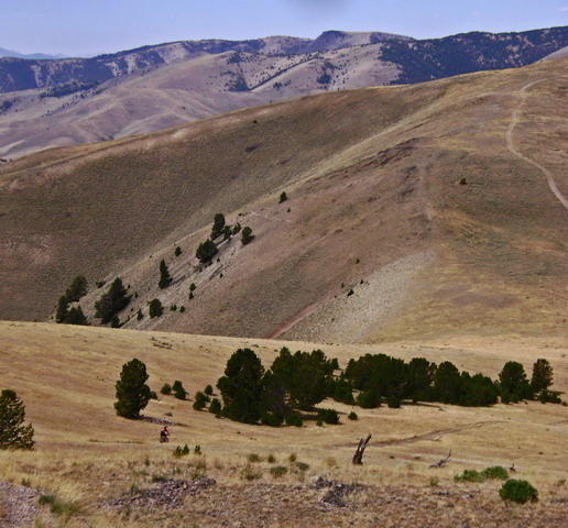
Yet another steep drop, just to climb right back up. Fun and exciting in a sick sort of way. I was happy to have my bike for the fast descents, but less happy with it while pushing up the next hill.
I got blown over more than once (right foot on standby for quick unclip), and had the distinct pleasure of being forced to brake while going uphill. We were having contests to see who could coast the furthest up the next hill without pedaling. I was really cooking, tailwind aided, up a short rise before the main "up." It suddenly got rocky and the event horizon meant I couldn't see what was ahead.
It's not often you have to grab a handful of brake while coasting uphill.
After 11 miles along the divide rollercoaster, a bit of singletrack thankfully contoured around the next fall-line climb. It also led to a developed spring.
The singletrack was a good omen. The divide was set to gain over a thousand more feet, and we weren't in the mood to push our bikes up more jeep road.
We ate a quick lunch at the base of the climb to Elk Mountain. Looking at the tiny trail leading away from the trees our hopes weren't high. But as we got into the thick of it, we were blown away to find a 90% rideable trail all the way to the top of Elk Mountain.
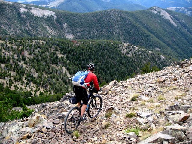
photo by MC
Heroic trailwork continued, with beautiful trail taking us along the divide, with big views into Idaho. Rocky talus was the theme higher up, eventually giving way to soft and forested trail. I was pinching myself at the wholly unexpected quality of the trail.
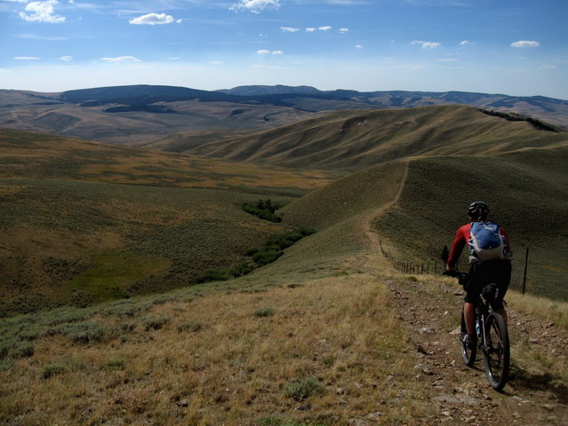
photo by MC
"Like all ridge trails, they never last long enough," says Mike.
How true, how true. Soon we were back on roller coaster jeep roads, sometimes rideable, sometimes not. The late afternoon wind was pretty incredible, and at Bannock Pass we hid in the semi-shelter of the "highway" sign to weigh our options.
Conversation was not easy in the wind. Mike could hardly hear what I was saying. Holding onto the maps was even harder.
While I still had dehydrated meals, I was dangerously low on snacks (on-the-bike food). I had expected things to be slow, but not quite 30 miles a day slow. But still, I had poorly estimated how much food I'd need for four days on the bike. If only Mike had caught the promised fish.... regardless, we weren't going to make it to Jackson for a resupply, as we had planned.
Mike still had food for another ~day, a combination of better planning and his ability to ride without constant food intake. Leadore was ~15 miles off route, in Idaho. Normally not a big deal for a cyclist -- no need to wait for someone to bum a ride from. But the wind made Leadore a non-option. 15 miles with that kind of headwind was the last thing either of us wanted to face this late in the day.
So I suggested Grant, MT. Put the wind to our backs and blast to the Canvas Cafe, a place I had eaten at during my '04 divide tour and also during the '05 race. I further suggested we pedal from there back to Lima to resupply, from our own food in the 'E'. This would split up our planned dirt road ride back to Lima, too.
The power of the sun on the ride to Grant was startling. I'd later learn that the high temperature that day was in the high 90's. No longer cooled by the incredible divide crosswinds, we finally felt the heat of the evening (!).
At Grant we peeped in the Canvas Cafe only to find it filled with junk. Oops. It's the only gig in town -- what little town there is.
Diesta, the owner, came out while we stood around looking at maps and GPS. She said the cafe was closed, but she always fixes dinner for cyclists who stay in her cabin. We rented her cabin for 25 bucks, complete with a Montana cold shower.
Supper was $5, and it was easily worth $20. Meat, beans, pasta, bread, pears, cottage cheese, cherry pie and pepsi. Even with that I was hungry when I went to bed.
Miles - 55
Day 4 - MC on the GDMBR
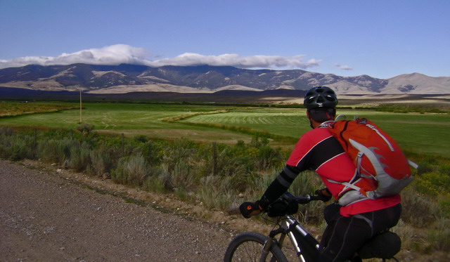
Two miles onto the GDMBR, from Mike:
"Ok, I'm sick of dirt roads."
It ain't singletrack, it's true, but I detected a little prejudice against this particular set of dirt roads from the grand master MC. His camera never came out.
From my perspective, it was a pleasant ride, and a perfect "rest day." You wouldn't think riding 70 miles on dirt, on the divide route, would be restful. But relative to what we'd been through, it was like coasting downhill -- the whole time.
This is one of the better stretches of the GDMBR -- it's vehicle free and has a great rural feel to it. Plus, we had views of the CDT and the terrain we'd been suffering through for the past three days. It was fun to stop and identify landmarks.
Three days on the CDT out, half a day on the GDMBR back. That speaks volumes.
Mileage - 70 easy ones.
In the next chapter we head out onto another CDT loop, this time based out of Jackson, MT.