Mike Curiak and I continue exploring the Continental Divide Trail (CDT).The original plan was to restart where we left off -- Bannock Pass. But given that our daily mileage limped along in the 30's, we didn't have enough time to complete the trail as planned -- and ride back.
Somehow the plan morphed into starting in Jackson (Montana) charting a new course for the first section reported to be "primo" by my route research. We'd skip ~50 trail miles and loop from Jackson instead.
So we drove from Lima to Jackson and stayed in the lodge. I think the hot spring is the only thing keeping Jackson alive. I took a dip and it was revitalizing for my hike-a-bike sore feet and calves.
I spent about an hour in front of the forest map the lodge had on the wall, right next to the bar and posted above a pile of kiddie toys. I should have spent more time studying it--a painful map error was in my (our) future.
Day 5 - Crags and a first for MCWe gathered food and changed a bit of gear before setting off in the morning. Once again it was 10 miles of pleasant and easy dirt roads to get into the thick of things--the perfect warmup for a day of climbing steep singletrack.
We rode south and west out of town, past Miner Lake and following Miner Creek. Immediately it was clear we were in completely different country. Even at 7000 feet the sage gave way to lodgepole pines. It felt more like Colorado at 10'000+.
Dirt road eased to 2-track, technical at times. Lava Mountain Trail on the GDMBR was the closest parallel.
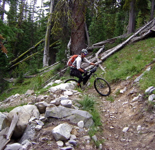
Just before joining the CDT we met a couple on a horse packing trip. They were just wrapping up a 7 day stint on the CDT, from Chief Joseph to Miner Lake. First they thought we were on a day ride. They refused to believe that we we were headed to Chief Joseph Pass.
"I'd really like to hear about it, if you make it. What about the rock slides, the talus? You wonder whether it's even safe to take a horse up there."
I wonder too. Bikepackers, on the other hand, can always walk (and we often do). If it's "safe" for a hiker, it's safe for us.
I asked Mike if he wanted to turn around, given their warning.
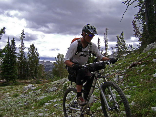
As we climbed I was delighted by familiarity. I'd never been here before, but deep memories were firing.
I spent a summer as a wilderness ranger for Salmon Challis National Forest. We worked in an area known as the Bighorn Crags, and I spent most of that summer wishing I had a bike to explore the wilderness.
Looking at photos and reading trip reports can only jog your memory so much. What about the other senses? There's nothing like being completely engulfed in it.
At last, I was riding in Crags-like terrain.
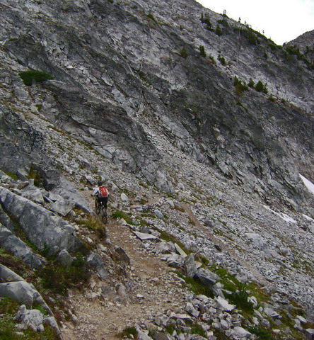
And that is
most definitely a good thing.
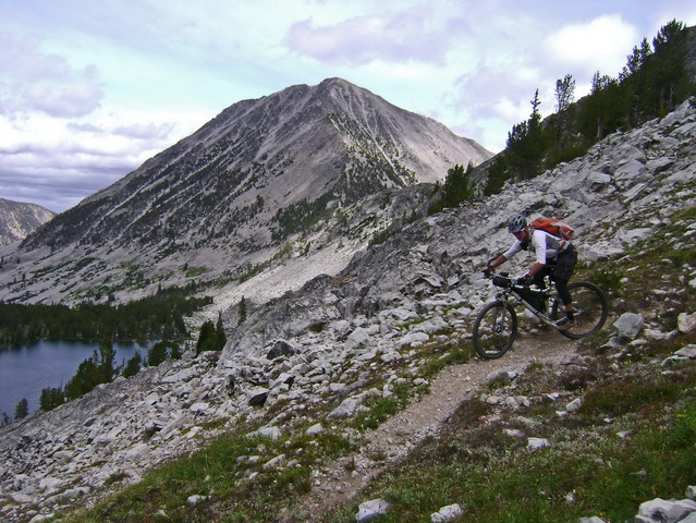
Cresting one saddle it was hard to believe there was a trail through these rugged mountains. With its twisted trees, sheer faces and crystal lakes any old trail would do, no matter how unrideable. But this trail went beyond rideable, well into the primo category.
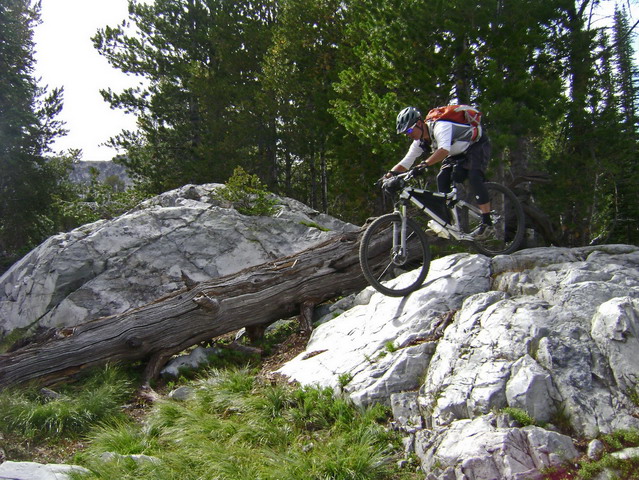
A virtual playground for bikes. The kind of trail, and day, that you hope never ends.
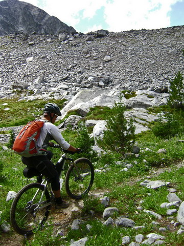
The afternoon waned as we passed Lena Lake, another picturesque cirque. It was hard to believe, but from here the trail got even better. Beautifully constructed contour trail took us to the Slag-a-melt drainage.
I passed Mike here where he had dabbed on a techy section that seemed like it shouldn't have given him much trouble. He went back to try it again and proceeded to slice his rear tire's sidewall.
I was waiting at a small pass, observing a family of grouse. I rode back down find him pulling dozens of goatheads from his tire (from Grand Junction, not here!). No more tubeless for Mike.
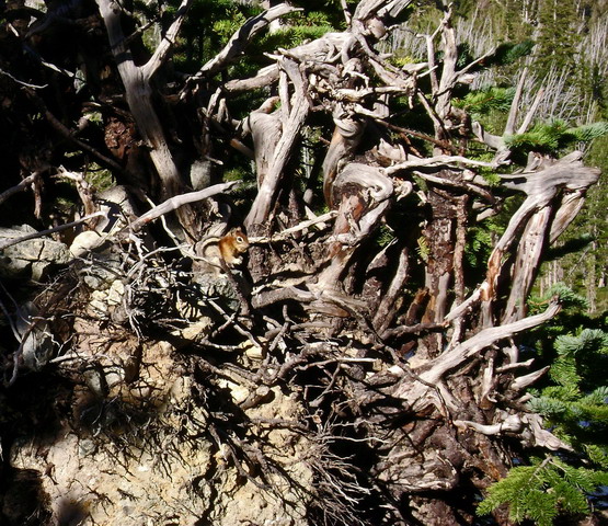
The trail lost its wilderness feel; the climb up to Slag-a-melt lakes was an ATV trail. Roots were exposed and gone were the contouring grades. Still a great, challenging climb.
I stopped to filter water at a creek. When I followed Mike's tracks they went to lower Slag-a-melt lake, where I found him gathering fire wood.
!?
It's 6:15p. Sundown is in ~3 hours. This is unprecedented! Mike stopping early?!
Everyone has a 'down' day every now and again. I wanted to keep moving through this incredible terrain. But camping next to an alpine lake had its appeal as well and the trail would be there tomorrow. I found some middle ground by ditching my gear and pedaling to the upper lake, then to the pass above both lakes.
I saw the same deer twice, eating from the same meadow. More old memories were not-so-subtly jogged as I pedaled the perimeter trail of the upper lake, evening light dancing on the peaks above me.
The wind blew throughout the night, but my tarp kept it off my face, and without the sage/cow allergies I actually slept much better than previous nights.
Day 6 - Pinky woes and berriesIt was different to know something about the trail ahead, at least for a short while. With 'rested' legs I enjoyed the climb more than I had the previous night, unloaded.
The uber-switchbacks on the descent didn't disappoint.
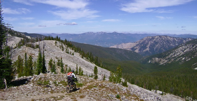
For the next 10 miles magical singletrack continued unabated as we traversed just below the continental divide: grin inducing descents, rapid fire switchbacks, rock monster challenges and the bikepacker's favorite: contouring singletrack.
For a mile the trail held a contour at almost exactly 8700 feet. Lovely.
We gained the divide at a small saddle. Here began a colossal descent into the Idaho.
It started innocently, then got progressively more rocky. The picture taking was good, as Mike and I alternated setting up shots while descending talus laden slopes. I hopped off the bike on one switchback after rounding it only to have the front tire become wedged.
One switchback later Mike stopped to take a photo and somehow got caught on his bike. I heard "oh shit!" and witnessed the "crash" from above, though it was difficult to tell exactly what happened.
"Are you OK?"
"Yeah..."
(pause)
"I broke my finger."
Even from 60' above I could see something was wrong with his pinky when he held his hand out. It was dislocated, but he was able to pop it back in, as I had done with my pinky some years ago.
At this point I began thinking about bailing options, but I don't think thoughts of that sort were on Mike's mind. He drained the adrenaline by continuing down the challenging trail, myself trailing him.
The plummet to Idaho proceeded to turn to super chunk. I've seen few downhills that keep your heart rate so high and require so much focus. I'd ride until my concentration failed, pulling off the trail to let Mike by. He'd then reach his limit and wait for me to pass further down.
Down. Down to fifty six hundred feet, the low point of the trip.
How Mike was able to ride with a broken/dislocated finger is beyond me. But he made no indications that it was going to be an issue at all. The trip must go on! A broken finger is just a bump in the road for Mike.
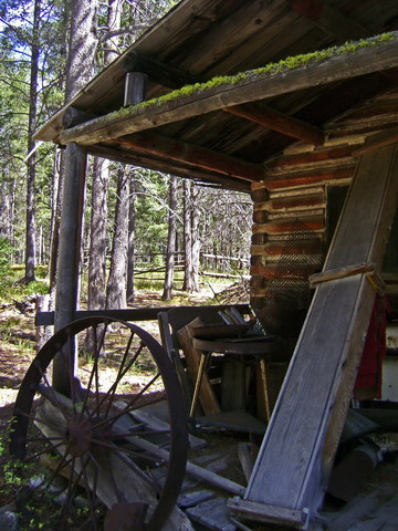
lunch at an old cabin
The less said about the climb back to the divide, the better. Except this: it was lined with berries, giving us the perfect excuse to take a break from the incessant bike pushing.
Singletrack awaited us on the divide, and it was tasty. Not a steep grade to be found. Midway we came upon a southbound section hiker, John, from the UK. We had a great chat, and he sure seemed to be enjoying his time without many concerns and definitely without any worry over pace.
At Big Hole pass the CDT becomes an ATV trail. It started out well enough. For 2.5 miles it was reasonable, traveling through mellow ups and downs. Soon enough the classic divide roller coastering began, and glancing at the maps and GPS didn't yield much enthusiasm for the trail ahead.
I had a GPS line down May Creek Trail, but conditions were unknown. I could find little reference to anyone using it. So there was a possibility of good trail there, but we'd spend the rest of the day pushing to get there.
After pushing retardedly steep pitches to 7700 feet I stopped at the crest of the fall-line descent and voiced what we'd both been thinking. (Heading back to Big Hole Pass and taking dirt into Wisdom, saving some time to explore the Pioneer Mountains).
"Speak now or forever hold your Big Hole..."
We turned around and never regretted it. The roads from Big Hole were a nice cruise for a while. But I made a deplorable error at one junction.
Two roads led to highway 43. One was labeled a mile shorter than the other, but started out with a gentle climb. I ran through both on my GPS and hastily decided on the shorter one, thinking it was the main travel route, and all downhill.
My reasoning isn't that important. We would soon name this road Retardo. It didn't continue to gently descend Ruby Creek. It kept climbing away from it. Hundreds of feet above, each foot of elevation gain was an insult. Sun setting and restaurants closing, we were burning good time.
Finally on pavement, I rode away from Mike's slow/heavy tires, occasionally stepping on it to make Wisdom by 9pm. I tried not to notice the other graded forest road entering the highway and how it would have saved us several miles and many a minute.
Still, it was a nice, crisp evening to be pedaling. It didn't feel much like a tail wind, but there was something surreal about pedal mashing into town, dimly lit and blue, at 18 mph. Almost felt like I was going too fast. The restaurant on the other side of town still said open, and though it was 9pm the staff graciously cooked us up a couple of burgers.
We crashed out in the motel across the street.
Day 7 - Shredded tires and other failures in the PioneersWe pedaled over to the Forest Service office @9am to obtain a forest map (such a map would have been proof against my map blunder the previous evening) and hopefully some trail beta. We found both, and a few trail routes back to Jackson were proposed.
The straightforward route sounded too easy, and though we had no info on connecting trails, the climb up Odell Mountain was rumored to be of quality.
It was. But a short distance up the trail Mike's chain slipped.
"I don't think the scenic route is such a good idea with this tire."
He counted 7 sidewall cuts, with several showing tube.
"I've got a park tire boot."
"Do you have seven of them?"
He tried some booting, but eventually resigned that his tire was done. It was highway time for him. This was definitely a rare trip for Mike. Usually over-prepared and unflinchingly steady, the CDT had seen him crash, injure a pinky, stop
before the sun went down and now bail on good singletrack due to a bike issue. Doesn't sound like the Mike I know, but everyone has their moments, I suppose.
I continued up the trail, hopeful that I could punch through the Pioneers and make it to Jackson by nightfall. Worst case I'd camp somewhere and meet Mike in the morning.
The climb was brilliant--a perfect blend of technical challenge with contour respite.
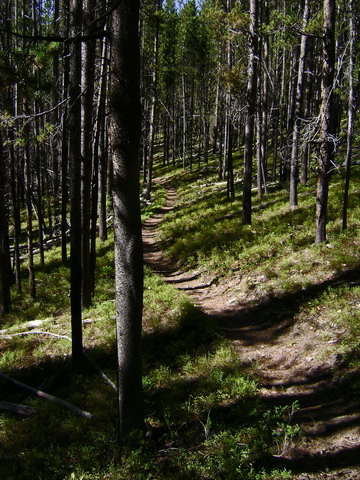
I dabbed a lot, but never walked more than a few feet at a time. After climbing about 3000 feet my legs were burning. The trail began contouring around Odell Mountain, and each time it entered a meadow there was zero sign of where to go. No CDT posts to look for, just blazes on far distant trees.
I'd head in a general contour, doing everything I could to prevent a dab (the meadows were full of running water and quite wet). Then I'd search up and down the meadow for a blaze or any sign of a trail.
This worked well until I got to the junction for Stewart Meadows. Good trail looked like it continued to Odell Lake. But twenty feet down my intended route I lost the trail. When alone I don't trust my eyes, having only one pair, so I retraced my steps on the trail and considered all possibilities.
No, no trail. Keep going.
For whatever reason, that's just what I did, kept going. I did find some blazes, and some pieces of rideable trail. But each meadow was increasingly impossible to decipher.
To my astonishment, I found orphaned pieces of roads. I'd get excited that I found something that was going to whisk me away to the Martin Mine (my next waypoint on the route). But 200 feet later there was literally no sign of the road anymore.
Eventually I was above the mine (per GPS) and standing in a glorious open meadow. Logically I should have turned around long before this, but adventure called and I pointed the bike down and held on. Rolling steeply through high grasses gave an uneasy feeling, but soon I found a bit of trail and some signage at the upper end of the mine.
The lone trail sign pointed me downhill, following the road that once went to the mine. Out of the meadow it was swallowed by the forest, including huge piles of downed trees. I searched for alternate lines or something I was missing, but there wasn't much.
I had dropped far and fought hard just to get where I was. I thought I was long past the point of no return. Yet still I continued. I pushed through a half dozen log jams, hopeful of improving conditions. If I could just get down to Stewart Meadows, some 2 miles away, a vague but known-to-be-traveled route awaited to take me to Jackson.
I stopped and realized that not only was this descent unlikely to improve, but it was going to burn all my elevation. At best it was going to be a rideable, rutted road. The thought occurred, "I could be descending that wonderful trail I climbed." Yeah, it's going to suck to go all the way back, but it's known suckiness. And there was a guaranteed reward.
So I turned around, and never regretted it. On the way back I stayed closer to what I think is the actual trail, but it was faint, and impossible to follow in the meadows.
The descent, as expected, was blissful. I stopped a few times for snacks at creeks, just to prolong the rocky mayhem.
I rolled back to Wisdom, en route to chocolate milk at the mercantile. The owner knows the area and despite careful explanation of what I had tried to do, he was convinced I had missed an obvious trail up there. I could only shake my head. Finally he asked which trailhead I had started from and the light bulb went off. "Oh, you went way up there?! No wonder things were so hard. Yeah, nobody goes that way anymore."
The ride back on the highway was a mere formality. The wind was not favorable, but I put in my ear buds and the tunes and memories from the trip flowed. I found the ride back to be highly enjoyable. I wouldn't have traded it for anything, perfectly happy to be where I was.
The views were big. There were few cars--even a couple of fellow cyclists on the road (one about to wrap up a trans America route). I'd gaze over at the divide and remember how good the riding was and how beautiful it was up there.
Simply a good trip.