Pages: 1 [2] 3
Reply Reply New Topic New Poll
  Topic Name: NCT in the LP of Michigan Reply #20 on: February 15, 2011, 10:49:33 PM
mmeiser

Less Stuff. More Freedom!


Location: SE Micigan
Posts: 207


View Profile WWW
« Reply #20 on: February 15, 2011, 10:49:33 PM »

Looking at the route starting at the state line.

1) though a subtle introduction to Michigan there are most likely some great sections following a lot of rivers between hillsdale, albion, battle creek.

2) It does head through some good sized towns like hillsdale. Have been on or across the route in this area, and have a pretty good idea of it. Typically rides like TransWisconsin and TransIowa would avoid this, but... I wouldn't sweat it. A little bit of city traffic isn't a huge deal... especially if such event was started on a Sat or Sunday. Indeed, it would be sweet because it is going to get more and more remote as it goes north. 

3) As the route goes from battle creek, up through yankee springs and East of Grand Rapids it's just awesome awesome country. I'm sure this will be nothing but fast rolling hills, twisting dirt roads, probably relatively dry / fast / reasonably well maintained dirt (unless it's pours a lot of rain). These are the sort of dirt roads that I will often ride on my road bike with 25mm skinnies without a problem... but of course it's just a subtle introduction to michigan and will get much more narly as it heads north.

4) North of GR (grand rapids), well I don't need to explain that, there's a bit of open before passing into Manistee where I'm sure the fun steps up a notch.

I have actually snowshoed the section along the manistee btw. That is bikeable?  Probably more and better singletrack in the Manistee area then the whole of the TransWisconsin.

I'm not even going to worry about the bike issues up in that area.  You were saying it's a grey area?  I'm of the just do it and debate about wether it was ok later. In my opinion unless something is explicitely out of bounds it is not out of bounds. No sense wasting time debating it when often noone really knows and you'd never get a straight answer. It is easy to reroute around such sections later.

I so wish I could ride this sooner, but I just got back from a trip.

I'm going to put it as #1 on my ride list... just need at least 4 if not 5 days that should at a minimum put me into the Manistee area. Indeed I attempted a trip last winter that went roughly through the same areas.
Logged


  Topic Name: NCT in the LP of Michigan Reply #21 on: February 16, 2011, 08:21:57 AM
clydeone


Posts: 16


View Profile
« Reply #21 on: February 16, 2011, 08:21:57 AM »

I'm trying to put together a section that would route us through at least cannonsburg SGA and Luton Park to add a little (I know its not alot) more single track to the section from Yankee to Rockford.  Might recon some of it for my LJ preps.  I am stoked about this!  Might even force me to make a seat bag and tarp  icon_biggrin
Logged

  Topic Name: NCT in the LP of Michigan Reply #22 on: February 17, 2011, 10:16:00 AM
JimL


Location: Michigan
Posts: 77


View Profile WWW
« Reply #22 on: February 17, 2011, 10:16:00 AM »

@mmeiser

The gray area isn't so much 'access' per se, although it would be nice to see some of the forbidden sections open up to bikes.  No, it's more figuring out a position between the hikers (who for the most part, are building the trails) and bikers.  As I mentioned, the tension between use groups tends to be quite high here in Michigan.  I know riding around Sheck's Place campground, there are carsonites with clear 'no horses' emblems, but the trails are generally torn up and littered with poop regardless.  Between Marilla and Dilling Road is generally an XC rider's dream playground, so you can imagine the reaction of hikers when a biker is hammering out a race pace w/o regard for other users of the trails.  Those are just two examples.  I'm sure there are many more, especially with hunting and fishing groups, who utilize the land the trails pass through.

@clydeone

Yea, deviating off the NCT 'roadie' course parts to add more valid single track would be a good thing.


Well winter is about to re-emerge here, so I'll probably not make it out to verify some of the roadie sections until the end of the month, but I do hope to have it all done before anyone would attempt to itt the entire route.

So, anyone willing to commit to a start date?  I'd say Mid-May at this point.  Looks like a full moon on the 17th, so maybe start either the 14th or the 21st?

Jim
Logged

  Topic Name: NCT in the LP of Michigan Reply #23 on: March 05, 2011, 06:28:25 AM
JimL


Location: Michigan
Posts: 77


View Profile WWW
« Reply #23 on: March 05, 2011, 06:28:25 AM »

Ok, had a little time to make a blog and put up some preliminaries.

http://transmichigan.blogspot.com/
Logged

  Topic Name: NCT in the LP of Michigan Reply #24 on: October 03, 2011, 09:53:58 AM
michigankr


Location: SE Michigan
Posts: 5


View Profile
« Reply #24 on: October 03, 2011, 09:53:58 AM »

Rode the NCT with a couple guys in August and loved it. The stuff up north was very technical and we spent a lot of our time hike-a-biking over trees.

By far, the best riding was along the Manistee River. I'm out in SE Michigan, and am considering driving out there again to re-ride it without the gear.
Logged

  Topic Name: NCT in the LP of Michigan Reply #25 on: October 05, 2011, 06:36:12 PM
mmeiser

Less Stuff. More Freedom!


Location: SE Micigan
Posts: 207


View Profile WWW
« Reply #25 on: October 05, 2011, 06:36:12 PM »

Sweet... so I've had to cancell my trip to do the tour divide due scheduling and resources so I think I'm going to do the NCT in michigan instead!

Starting perhaps the 17th of this month.

Anyone in!?  Smiley

Seriously though, I just need to get the GPX file asap.
Logged


  Topic Name: NCT in the LP of Michigan Reply #26 on: October 05, 2011, 06:37:07 PM
mmeiser

Less Stuff. More Freedom!


Location: SE Micigan
Posts: 207


View Profile WWW
« Reply #26 on: October 05, 2011, 06:37:07 PM »

btw, am from SE michigan.

Would be going very light, tarp, bag, etc, etc.
Logged


  Topic Name: NCT in the LP of Michigan Reply #27 on: October 05, 2011, 06:47:37 PM
mmeiser

Less Stuff. More Freedom!


Location: SE Micigan
Posts: 207


View Profile WWW
« Reply #27 on: October 05, 2011, 06:47:37 PM »

done, already fully viewable on my android phone via gmaps: http://maps.google.com/maps/...

Android phone will work, of course a GPS would be preferred, wasn't going to use one on the divide, but one is a must for this. Where can I score one in a week... hmm.
Logged


  Topic Name: NCT in the LP of Michigan Reply #28 on: October 06, 2011, 05:06:17 AM
michigankr


Location: SE Michigan
Posts: 5


View Profile
« Reply #28 on: October 06, 2011, 05:06:17 AM »

Hey,

I just pulled the gpx file from the link above: transmichigan...

Be prepared for a decent amount of pavement and dirt roads. After White Cloud, the amount of single track diminishes. I'd focus on the top half of our beloved lower penninsula if I did it again.

The first 50 - 80 miles are super technical, but we also hit it after a storm came through and knocked trees and branches down. Mosquitos were bad in August, but if you're going this month, you should get the double bonus of beautiful fall leaves and subdued insect aggression.

Good luck!
Logged

  Topic Name: NCT in the LP of Michigan Reply #29 on: October 06, 2011, 05:34:29 AM
mmeiser

Less Stuff. More Freedom!


Location: SE Micigan
Posts: 207


View Profile WWW
« Reply #29 on: October 06, 2011, 05:34:29 AM »

I will be riding my salsa fargo which I'm just finishing putting STI levers on. Will probably just ride the 2.1 nanoraptors i have on it. I prefer Vulpine 1.9" for road, but I expect a fair bit of sand so the slower tire is probably fine. To be clear I pulled a 20.5 average riding nanoraptors on a group ride with the roadies this summer. LOL. The biggest issue with the fargo is drag, but I love my bars up high on the off road and back road.

Am really looking forward to the singletrack!!   Exactly what I need. Some R&R, campfires, backroads, trails and fall color.

Have snowshoed the manistee, am looking forward to biking it.

I was thinking of completely foregoing a bug net.  I don't think this will be a problem unless we get a warm snap... and it'd have to be a pretty warm snap. Mosquitos like to hover just around dusk, but if it's below 55 or so they disappear completely overnight.

Baring any issues like huge headwinds I'm going to ride up the west coast on road and then come down the interior on the trail.

I doubt it'll be a whole lot of fun, but I want to complete the southern end of the trail just to asses it.

The only piece of gear I could really use is a GPS I think.

Anyone know where I can pick up a used Garmin Vista. I'm not that into getting it new since I probably won't use it much.

Will post my gear list hear as I get it finallized. It should be very spartan.

The nods to cold weather will be a down jacket, down bag, merino wool base layers, oversized rain jacket and pvc pants in case everything goes to hell in a hand bag (mostly I just use them around camp)

Will probably bring a heavier headband for the ears... was thinking of bringing only some gortex overmits for gloves.
Logged


  Topic Name: NCT in the LP of Michigan Reply #30 on: October 07, 2011, 10:05:48 PM
mmeiser

Less Stuff. More Freedom!


Location: SE Micigan
Posts: 207


View Profile WWW
« Reply #30 on: October 07, 2011, 10:05:48 PM »

Any recommendations on how to chop the GPS file and put it on a garmin Vista?  I assume if nothing else I can break down the GPX file by just slinging code. It's something like a max of 250 waypoints per track I guess? Don't even have my hands on one yet though.

Logistics are coming together fast now.

I still don't have a GPS in hand, but I think I'm going to rent one from takeahikegps.com.

Will be riding salsa fargo with hopefully about 10lbs of gear.

Am going to bike to chicago for a friends wedding 12th,13, arriving early 14th, wedding 15th ... his wedding is thereason I delayed my trip out west to do the divide... the nct is plan B.

I'm then going to turn and burn after the wedding and see how fast I can make tracks up the west coast of michigan.  Am hoping for 150 mile days to start. Depends on wind and unknown factors.

I'm going to research the beaches of lake michigan. Am hoping to try my hand at riding at least one stretch of endless beach.

Eventually I'll slow down and stop to smell the roses.  Hopefully that'll be in the Manistee area.

I'll then continue up to the makinaw bridge where I'll come back down the entire lower michigan stretch of the NCT.

Hopefully I'll be able to video and photo document and blog the entire thing, including posting gps data as I go. Am going to be shooting with diital camera and HTC incredible, blogging/photo bloging/video blogging, etc with HTC incredible. Will also have GPS. As far as I'm concerned this is a sh*t ton of digital crap. More then I like to carry and probably with lithium ion batteries a large part of my base weight.
Logged


  Topic Name: NCT in the LP of Michigan Reply #31 on: October 08, 2011, 03:25:25 AM
michigankr


Location: SE Michigan
Posts: 5


View Profile
« Reply #31 on: October 08, 2011, 03:25:25 AM »

For the GPS, try and hack the file into mank 250 pt routes. This is what I wish we had done for our trip. Too bad Garmin doesn't have a macro for that when you're dealing with a massive file.

Let me know if you have any luck. I tried putting extra memory in my Vista, but that didn't allow me to put in larger track files. Admittedly, this could have been completely user error.
Logged

  Topic Name: NCT in the LP of Michigan Reply #32 on: October 09, 2011, 07:44:41 AM
JimL


Location: Michigan
Posts: 77


View Profile WWW
« Reply #32 on: October 09, 2011, 07:44:41 AM »

Hey guys, sorry for the delay.

I've posted the split track up on the blog and copied the link below.  10000 points - 20 tracks, 500 points per track.

I use topofusion to do most all of this track stuff (make, slice, dice, reduce, etc.), excepting loading maps from the Garmin software.  If you need different resolutions of reduction (fewer tracks, less points, etc.), let me know and I can post those as well.  I use a Garmin 60csx (batteries in every town, etc.) and have never had any issues with going back and forth between the computer and the unit - running win xp in vmware on osx.  GPSBabel on the mac works for track transfer as well.  ymmv.

I've not yet had the gumption to through ride the route yet this year, as my spring rides put quite a dent in my summer riding.  My current plan for the week of 17th -> 22nd is to go to Fruita, but if that falls through and the weather looks good I may track up from wc to mac.  When I rode some sections in June the nettles and ferns were already sky high and I crashed quite a few times hitting stuff in the underbrush.  Then while laying there trying to figure out what to hell happened, the flies and mosquitoes were having a full on assault.   icon_scratch

As far as going ultralight on the route, (wc -> mac city)- I do think you could go w/o sleeping gear and hit motels and fish/deer cabin rentals all the way.  You would have to be willing to go off course for some of these services, some up to about 5-6 miles one way.  So if you wanna xc pace rip all the singletrack minimally loaded, sleep in beds, take showers and have beers with a hot dinner, I'd say it's doable.

And be ready for hunters and fishermen!  Fall is definitely not a serene season on the NCT.  A bit of hunter orange might be advisable, I generally wear a full on orange jersey this time of year...

http://trey.aiserv.net/~jal/transmichigan_2011_reduced_split.gpx

Logged

  Topic Name: NCT in the LP of Michigan Reply #33 on: October 09, 2011, 12:41:32 PM
mmeiser

Less Stuff. More Freedom!


Location: SE Micigan
Posts: 207


View Profile WWW
« Reply #33 on: October 09, 2011, 12:41:32 PM »

Just an FYI, I decided to rent from takeahikegps.com

$38 + shipping for three weeks rental.  Can't beat that. Especially on such short notice.

They even offered to preload the route, topo maps and anything else I needed.

Went with the Garmin Summit HC btw... no vista hcx were available... don't know all the feature differences but it should do everything I need.. I hope. Smiley

I'm going to leave on wednesday... to chicago and then on up the west coast of michigan.

Spending the day pimping out my Fargo.  Putting the STI levers on it seems to have worked wonderfully. Now have orginal XT rear der, new 105 front der (XT front der not compatible with STI different cable movement!), two Travel Agent cable doublers an Ultegra left shifter and a durace 9-speed right.   Stopping power is as good as it was with the mountain levers and shifting is dreamy, just like on my road bike. Will post some pics later.

Am working on putting together my gear, will hopefully be able to post gear list and weights later.
Logged


  Topic Name: NCT in the LP of Michigan Reply #34 on: October 12, 2011, 11:10:49 AM
mmeiser

Less Stuff. More Freedom!


Location: SE Micigan
Posts: 207


View Profile WWW
« Reply #34 on: October 12, 2011, 11:10:49 AM »

Pardon my french... but f'ck... I recieved my gps from takeahikegps it has only the most basic rudimentary base map on it. I was plenty clear when I said I needed it to show all the roads and he was plenty clear when he said it was no problem... right now I have the NCT loaded but the only roads on the base maps are the main freeways.. in a word... 31 and i-75... that's it.

I'm not exactly going to purchase and install a $150 map pack on a flipping rental gps.

And I'm supposed to be headed out the door right now and can't get a hold of them. I had to leave a message.

Am extremely mad.
Logged


  Topic Name: NCT in the LP of Michigan Reply #35 on: October 12, 2011, 12:47:52 PM
mmeiser

Less Stuff. More Freedom!


Location: SE Micigan
Posts: 207


View Profile WWW
« Reply #35 on: October 12, 2011, 12:47:52 PM »

found a free topo map of michigan online, hopefully it will work. Also the device memory is an extreme limitation...again the takeahikegps guy said it wouldn't be.  Grrr... I was able to select "enough" of the state so as to not be useless.  Been waiting for over an hour for the maps to upload to the GPS with Garmin's map uploader software.

Have repacked bike twice... I should have left four hours ago.  Guess I'll just have to ride all night.
Logged


  Topic Name: NCT in the LP of Michigan Reply #36 on: October 12, 2011, 03:59:18 PM
mmeiser

Less Stuff. More Freedom!


Location: SE Micigan
Posts: 207


View Profile WWW
« Reply #36 on: October 12, 2011, 03:59:18 PM »

Done... as in I delayed my trip 24 flipping hours to wait for a GPS from takeahikegps, they had said it would be loaded with the route, but then told me the route wasn't in the right format or corrupt... I later was able to load the exact route i sent them a link to without any problem.   They said it would contain street maps loaded... they weren't... they said it was because they thought the route I was loading had maps... obviously they didn't even bother to click on the link.

So... I tried downloading a map pack from GPSFileDepot.com... after three hours I had to kill it... it failed to load.

So... I normally wouldn't do this, but the software kept prompting me to update the GPS software... after over an hour I had to pull the plug on that.

Device is now bricked.

TakeahikeGPS said they don't have any others for rent right now and said they would "only charge me for shipping".

I feel really bad for them... they seem like nice people but they have completely 100% failed me, and the garmin software failed... twice.. .is their mac software just crap?   But at the same time I'm not really in the mood for having the privelage of having my time wasted and my trip delayed.

I guess I'm going to get up tomorrow at 2am and see if I can get in 150-200 miles tomorrow to get back on schedule. At least that will be fun.

Now I need to figure out how to get printouts of the entire NCT in Michigan LP.
Logged


  Topic Name: NCT in the LP of Michigan Reply #37 on: October 12, 2011, 04:33:31 PM
mmeiser

Less Stuff. More Freedom!


Location: SE Micigan
Posts: 207


View Profile WWW
« Reply #37 on: October 12, 2011, 04:33:31 PM »

one final bit of due process, called garmin tech support... it is most definitely and uselessly bricked, we tried everything. I assume it is now a warranty issue, but that's between takeahikegps and them.

I'm not so sure I wouldn't recommend take a hike or try them again in the future... this is just... extremely unlucky.

Am still trying to find a GPX to print service... playing with GPSvisualizer. Will let you know how that turns out. If anyone has any recommendations please do tell.

Hoping I'm not spamming bikepacking.net to badly... if I couldn't share I think I'd just go mad.
Logged


  Topic Name: NCT in the LP of Michigan Reply #38 on: October 18, 2011, 09:03:15 AM
mmeiser

Less Stuff. More Freedom!


Location: SE Micigan
Posts: 207


View Profile WWW
« Reply #38 on: October 18, 2011, 09:03:15 AM »

An update, things are going well. I'm riding north up the coast to start the NCT. The NCT organization is based in Lowell Michigan. Am stopping in tomorrow to pick up some maps.

Btw, on my way over to Chicago from Toledo I did 170 miles on Mich backroads on day one and 120 on day two coming into Chicago despite 20+ mph headwinds. Only regret. Not getting a pic of my bikepacking setup on the front of a Chicago CTA bus, lol.

Have been posting pics at Flickr.com/photos/mmeiser2

Cheers!
Logged


  Topic Name: NCT in the LP of Michigan Reply #39 on: October 31, 2011, 08:49:07 AM
mmeiser

Less Stuff. More Freedom!


Location: SE Micigan
Posts: 207


View Profile WWW
« Reply #39 on: October 31, 2011, 08:49:07 AM »

So!  I'm back from riding the NCT in lower Michigan!

Just got back yesterday afternoon after riding / walking / scouting the last few sections of the NCT from Yankee Springs south to the state line and home. Road/walked straight through the night getting in 170 or so miles.

All I can say is it was quite foggy on the St. Joseph river at 4am. Smiley


I owe a complete breakdown, pics showing maps with open biking sections, notes on terrain, conditions and workarounds, but first just a summary.

In short the LP portion of the NCT was wonderful with a few exceptions.

Probably 90% of it just the sort of dirt roads, gravel grinding and huge amounts of single track you'd want if you were going to make a "Trans Michigan Adventure Trail" or do a "Trans Michigan Unsupported Race"

I did NOT get all the way up to traverse city and mackinaw... nor did I ride every single piece of single track down to the southern border.  In short because the few pieces of single track in southern part of the trail is either underutilized / overgrown... used by hourses or worse.

Overall was a lot of fun despite the unusual amounts of rain and cold weather we've had since the 13th. I don't think it got into the 60's but maybe one day.  Most days were in the 40's and 50's.


== Manistee National Forest area ==

The single track open to biking through the Manistee national forest was amazing, magnificent, varied and abundant!

It is there I really slowed down and enjoyed myself, I even got off the bike and walked for a day with a fellow hiker. 

I road three or four straight days of single track in the Manistee National forest region.  I'd say as many as 200 miles though I'll have to go and total it up.  Perhaps it just felt like 200 miles since singletrack is much slower then the gravel grinding I'm used to.

If we were going to do a Trans Michigan Un-race I would likely focus on the Manistee region. It's simply wonderful.

But I would NOT focus exclusively on the single track. There's way more to the Manistee region then just excellent single track.

The only sections of the NCT not open to biking in the manistee have SUPERB and straightforward dirt road workarounds. Indeed I really really loved the seasonal dirt roads in the Manistee region. They're magnificent.

One could easily put together a 300-500 mile loop that just highlights the superb single track and dirt roads in the manistee region.

I think what amazed me most was not just the abundance, but how varied the single track was in the manistee. 

Tons of technical up and down stuff with switchbacks along the maninstee river... killer but all very ride able if you have a low enough granny and enough stamina.

Tons of flowing single track through open regions bouncing back from being clear cut which I thought were absolutely wonderful.

An amazing boardwalk through high open marshland.

Some ridge / bluff running along the Manistee.

I fell in love with the Manistee region back when I did some snowshoeing along it some ten years ago... but somehow my expectations were met, exceeded and then overwhelmed.


== south of grand rapids Michigan ==

To the south though there were some jems in the Yankee Springs / Augusta / Fort Custer regions in the form of dirt roads and a tiny bit of single track was not particularly cut out for just wholesale unsupported racing.

The southern region was an "adventure" of a different sort.   In Jonesville / Hillsdale it goes right through the city and I rolled right by Walmart and other fine modern shopping institutions on crappy suburban bike paths.

South of Yankee Springs I bushwhacked trail through briars and over logs and had to go through the brush around log jams as the trail was so under utilized. Keep in mind this is fall. I can't imagine how impassible this section is in mid-summer.

Coming south into Augusta / Battle Creek I road miles of grassy farm fields, well marked, but with narry a track worn through them... which I actually really enjoyed because I spend so much time riding by farm fields it was an interesting perspective to ride through the back fields... if a little rough and slow.

As I approached Fort Custer recreation area, I did miles of horse trail... of the worst variety... if not churned up sandy, then mud... and often vary rutted and washed out.  And the horse poop. Only to be dumped onto a closed out wash covered over with briars I needed to hack and push my way up before the trail popped out on a road and I finally got out of that mess.

Of the whole trip the only parts I would not recommend are the Norris Road area of singletrack south of Yankee Springs as it's very overgrown and almost completely unmaintained.... and the horse trails north of Fort Custer. These both have absolutely superb dirt road workarounds.


A finall word on what is and what is not bike-able. 

The map guy at the NCT headquarters in Lowell gave me a zerox of the manistee region showing what was open and not open to biking.  It was wonderful and accurate as I could easily do an alternative dirt road route and return right to the singletrack. I do wish they'd mark which portions are bikeable and which are not on the wonderful official NCT maps though.

What I've found is that there are standardized stickers at trail heads and road crossings for the NCT that say (to paraphrase) "this trail is for hiking only, motorized wheeled vehicles or any other use is prohibited".... this has absolutely no bearing on wether the trails are bikeable or not.  In the manistee region biking / no biking stickers were present about 90% of the time, but I couldn't always be absolutely certain what was open and what wasn't until sometimes after I got into it.

Also... for the most part State Game areas are NOT open to biking.

When riding by / through the Barry State game area and Yankee Springs there were absolutely NO signs for / against biking on the NCT.  Perhaps they just don't care... since the low amount of traffic on the NCT obviously hasn't had much impact.   Or perhaps it is all supposed to be closed and they just assume that the standardized NCT sign means no biking.    However... I didn't see one...ZERO no-biking signs in the area... nor any real errosion problems.  Which is odd because yankee springs is a huge hot bed for mountain biking and one of the most heavily used and heavily marked and maintained mountain biking systems in the state.   The NCT would criss cross mountain bike trails in Yankee Springs regularly... but it was quite obvious to me that the high bike traffic stuck to the mountain bike specific trails.

As with Yankee Springs so to as I traveled south.  There were just NO pro-biking or no-biking signs on singletrack.  Perhaps this was because they just figured "why would anyone bike this".... and indeed with barely tracks worn through fields... and fence crossings and the like... most people probably wouldn't think to bike it.  But I did... and I enjoyed it all... for the most part.

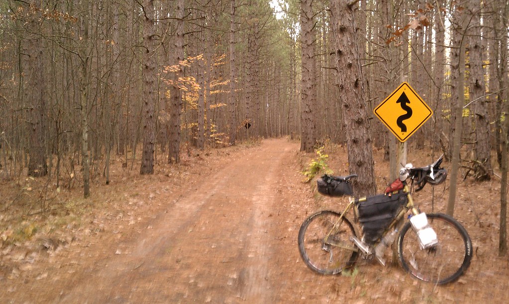
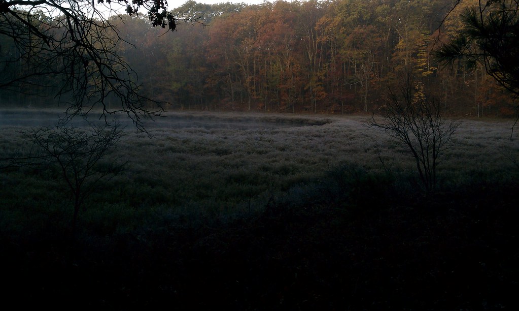
Oh... some pics follow... many, many many more are still on the camera. These are just pics snapped with my android phone.


Twin lake campground, it was hard not to call it a day here by mmeiser2, on Flickr
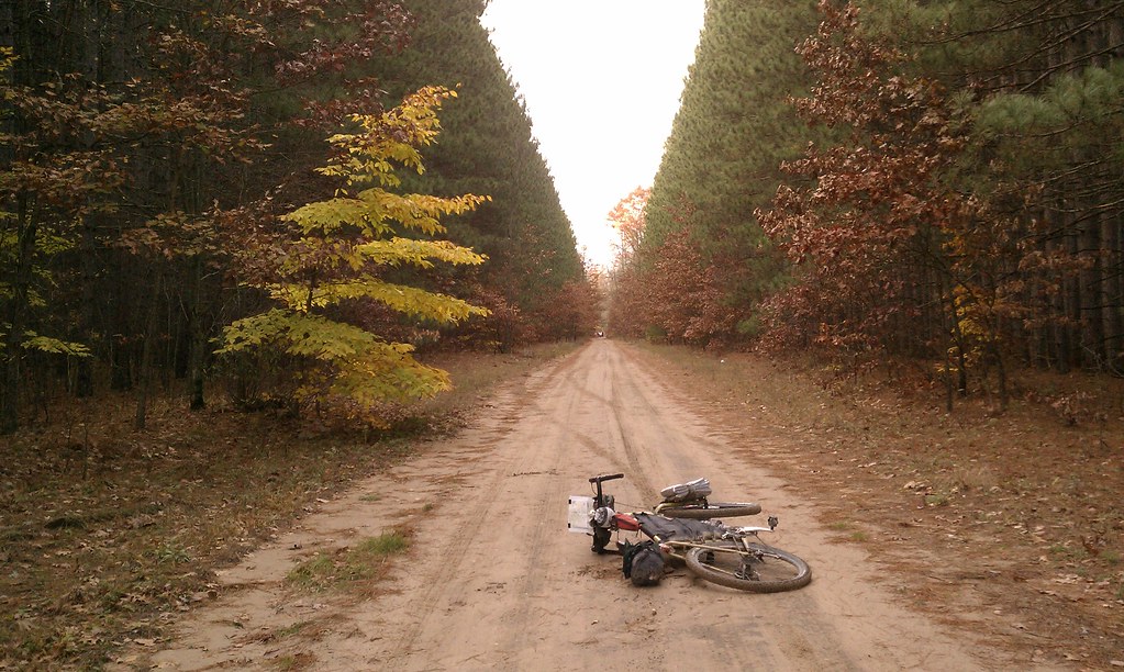

Pine alley by mmeiser2, on Flickr


Fargo country by mmeiser2, on Flickr


My breakfast view on the North Country Trail by mmeiser2, on Flickr
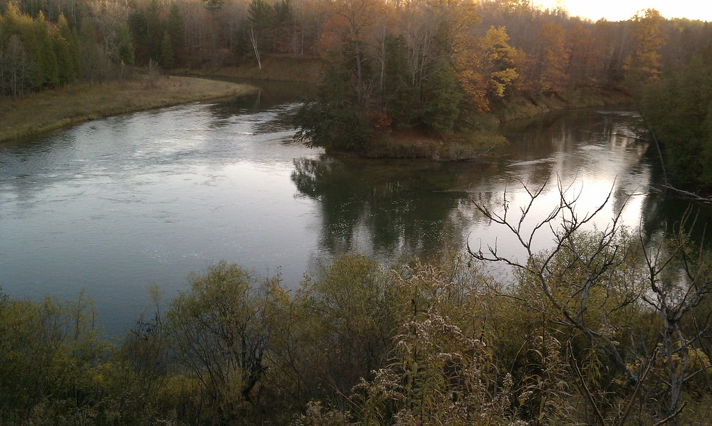

Yester-evening on the Manistee River by mmeiser2, on Flickr
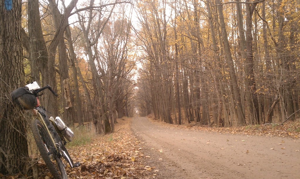

Almost home by mmeiser2, on Flickr

Note the blue blaze in the top right of the pic above... this is part of the official NCT route.

Many more pics, and perhaps even some videos will follow.
Logged

  Pages: 1 [2] 3
Reply New Topic New Poll
Jump to: