 Topic Name: New bikepacking route and TR - Desert Solitaire Topic Name: New bikepacking route and TR - Desert Solitaire
|
on: December 12, 2024, 10:37:41 PM
|
evdog
Location: San Diego
Posts: 387

|
 |
« on: December 12, 2024, 10:37:41 PM » |
|
For those of you who need something to do during fall and spring shoulder seasons, I finished putting together a new bikepacking route earlier this year that I'm calling Desert Solitaire. Last month I rode the full loop - trip report to follow. Desert Solitaire connects two historic Native American trading routes between the Colorado River and the coast. Both of these are now popular OHV trails - the Bradshaw Trail and the Mojave Road. Starting in the late 1850's and early 1860s they were developed into competing wagon routes between Los Angeles and the gold fields of Arizona, but were abandoned by 1880. I linked them together into a loop via the Arizona Peace Trail in the east and BLM roads and Joshua Tree NP in the west. A bunch of scouting was done to remove as many sections of deep sand as possible and replace with better and more rideable trail. The route is 664miles with around 37,500ft of vert. 2% singletrack, 81% dirt road (much of that on backcountry jeep trails), 1% bike path and 16% pavement. The best time to ride is March just after time change until mid/late April when temps are warming, there is still water on route and flowers are blooming. Second best time is mid/late Oct to late November. Riding during a full moon period like I did makes night riding super cool. The route gets up over 5k in a couple spots where winter storms can be an issue. You could have scorching temps down low on the same trip. Water is scarce so you'll need to capacity for up to 80 miles. There is plenty of sand but you don't need a fat bike. And you'd be hating life on a gravel bike. The sweet spot is about what I ran, 3.0 front and 2.8 rear. Aired down, I was able to ride a lot of the worst sand. The RideWithGPS link has a ton more info. As does the IG account I set up. Any questions, post up! NOTE: UPDATED ROUTE 2/23/25 - see link above for V2.0. Significant changes both sides of Lake Havasu, from Yermo to Johnson Valley and top of Rattlesnake Canyon down to Yucca Valley (more dirt, less sand!)  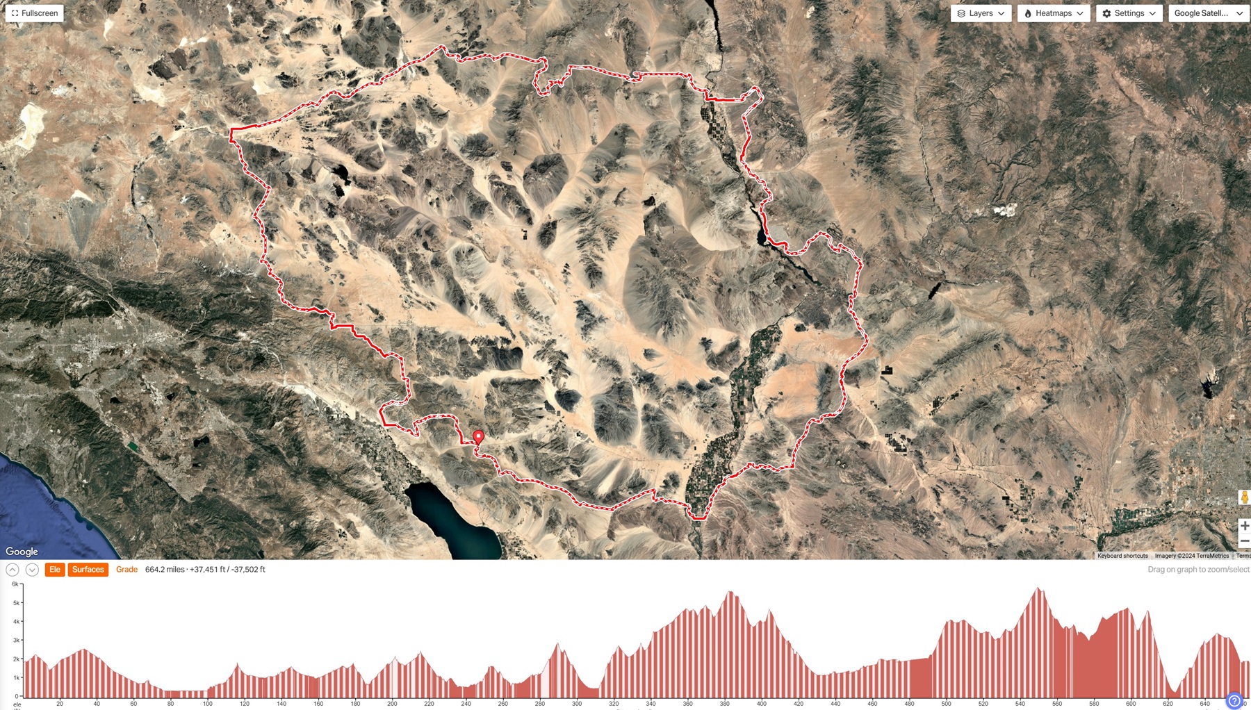 |
|
|
|
« Last Edit: April 11, 2025, 09:23:56 PM by evdog »
|
 Logged
|
|
|
|
 Topic Name: New bikepacking route and TR - Desert Solitaire Topic Name: New bikepacking route and TR - Desert Solitaire
|
Reply #1 on: December 13, 2024, 12:41:18 AM
|
evdog
Location: San Diego
Posts: 387

|
 |
« Reply #1 on: December 13, 2024, 12:41:18 AM » |
|
Well, I put the route together so I figured I should be the first person to ride it. But I wasn't sure when I'd have time since I figured it would take me around 10 days. Then I had a window open up unexpectedly in late October. Unfortunately it was mid 90s across the lower deserts, too hot for me. As luck would have it I some appointments canceled in November which opened up another window this time with a favorable forecast. So I pulled the trigger before mother nature changed her mind. Just as I was setting things up, the forecast changed to show a storm blowing through the Big Bear area two days into my planned ride. I was able to modify my plans to start just north of those mountains so I could get over them before the storm hit. After that, the weather was looking great. I had found a website called Neighbor.com where you can rent parking spots. There was one available near the end of the Mojave Road which fit my new itinerary and was only 6 miles off route. All that was left was to pack up my bike and gear, and go. My old Carver Ti hardtail has had 3.0 and 2.8 tires on it for a few years now, mostly for desert exploring. This was my rig for the trip. Setup was sleep kit in my handlebar bag, tools and quick access stuff in frame bag, and clothing/food in seat bag. Plus a backpack for extra water, food, clothing. I got cold feet (literally) camping the night before I took off as the temps went below freezing. So I strapped a full wool blanket on my pack at the last minute. I would not regret that decision at all... Sleep kit was a 30 degree bag and bivy sack. Minimal clothing except I carried a pair of riding pants for an extra lower body layer. I had two 1L water bottles on the handlebar, another on the downtube, and a 6L MSR dromedary in my backpack for longer water carries. I did bring a stove so I could have hot food. Day 1 My start was a bit later than I wanted as I had to drop my truck off at the parking spot. I was fine with that as temps had gone below freezing and it still in the low 40s as I pedaled away around 830. My warmup ride to the starting point of Desert Solitaire went right past the Camp Cady monument on Harvard Road. Camp Cady was a military outpost on the Mojave Road, near its intersection with the Old Spanish Trail between Santa Fe and LA. The actual site of Camp Cady is in the Mojave River wash a few miles away, no longer accessible by vehicle. The current Mojave Road OHV route now follows a powerline road just north of the wash. Where it crosses Harvard Road is considered by many to be its western terminus. That is where my ride on Desert Solitaire would begin.  My view for the next hour. At least it rode well.  The route broke away from the powerline where it swung south around Newberry Cairn 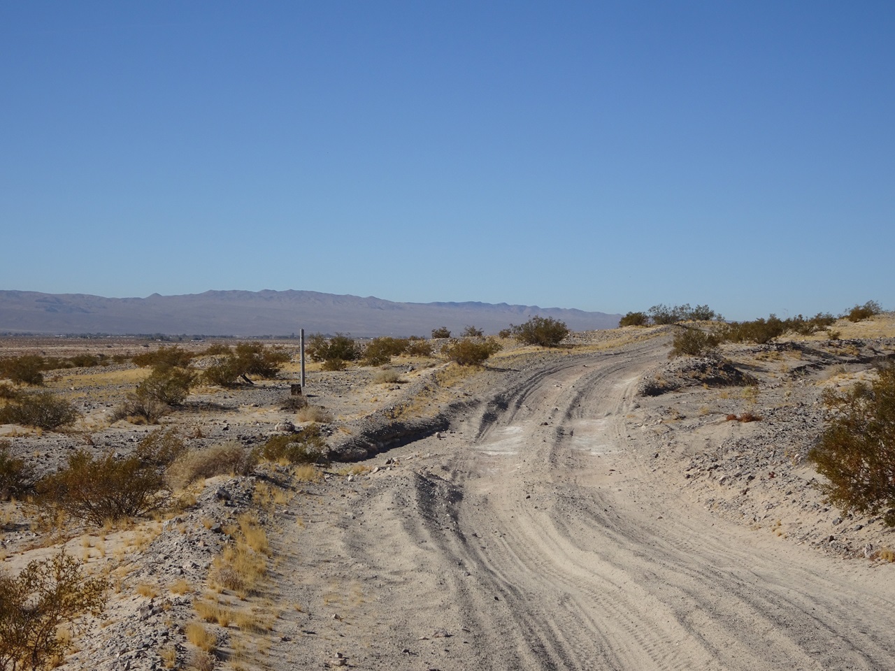 There was a good view of mountains to the south and to the north. 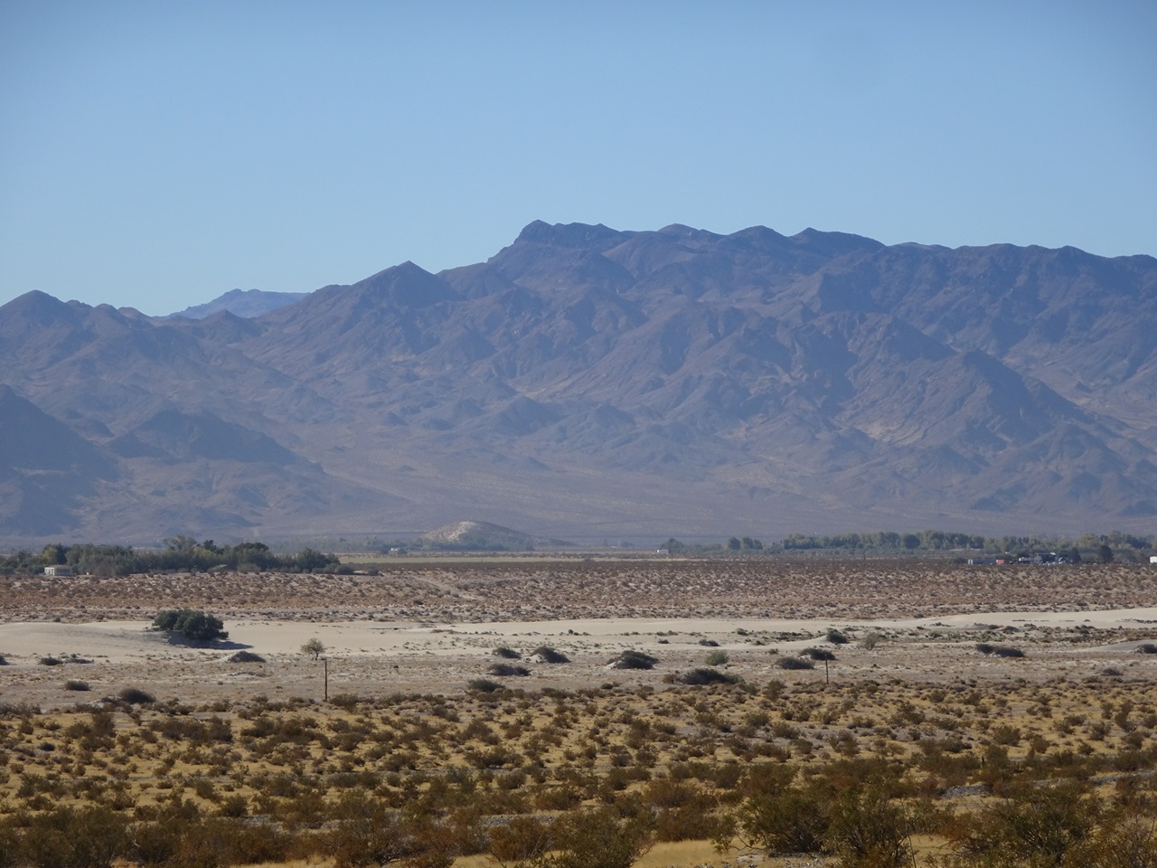 On the stretch of pavement heading into Yermo I passed the site of the original Del Taco. Sign said it was open. It wasn't.  The sign said there was water. There was not.  It wasn't lunchtime yet so I kept going. Guess I'll have to stop in another time : )  Lots of tanks getting loaded up at the Marine Corps depot 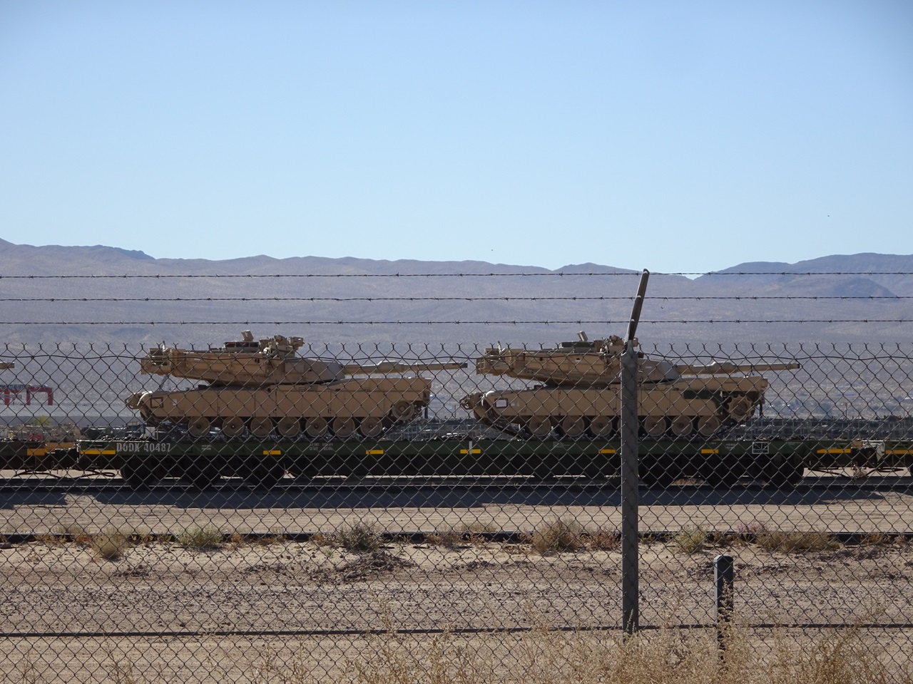 I stopped at the market in Daggett for some beverages before I started my climb up into the hills. The first climb of the trip would be about 2,000ft. Looking back down to Yermo. 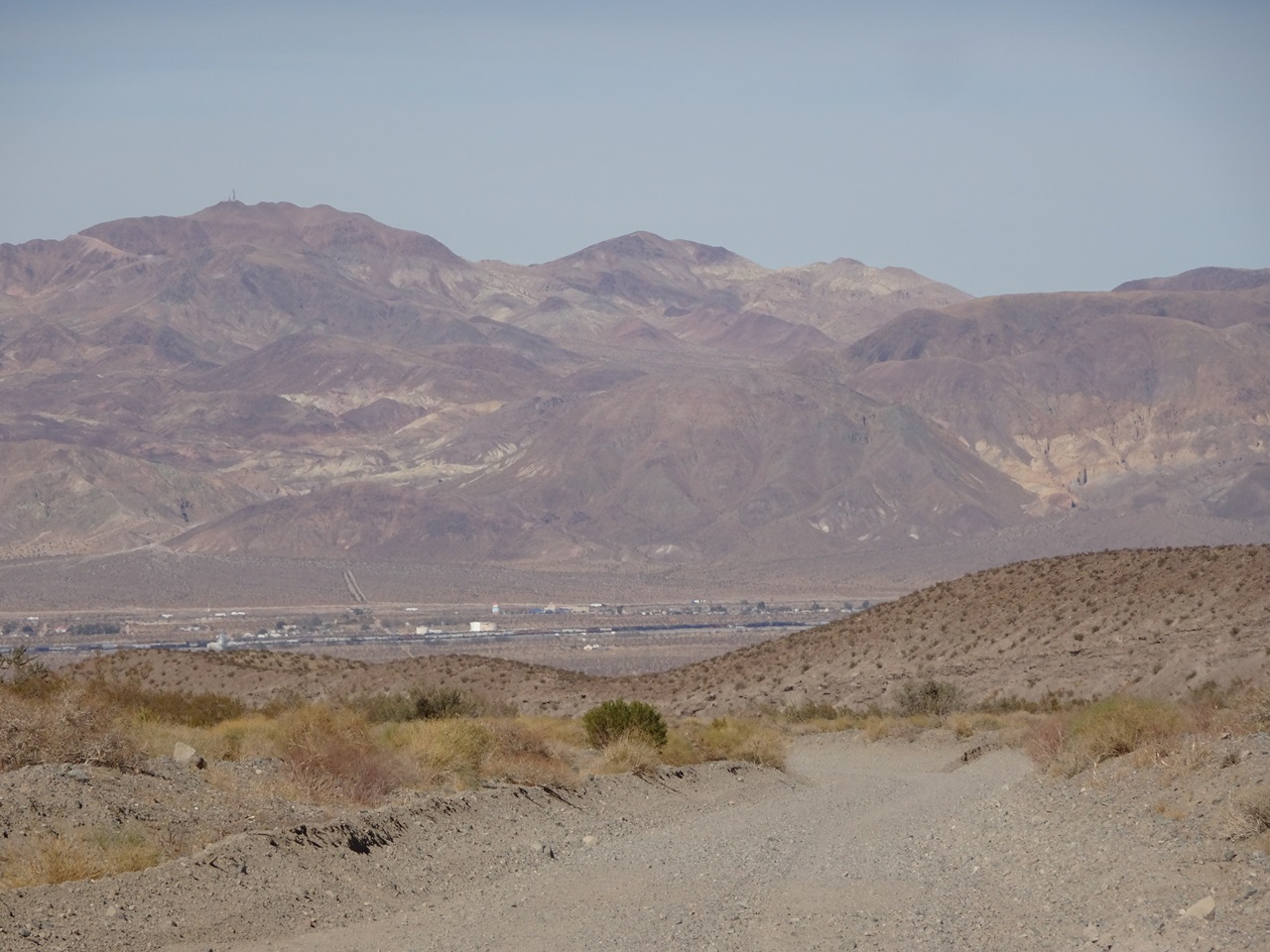 The first hour of the climb was pretty boring and straight. Then the scenery got more interesting as a field of Mojave Yucca and some rock formations appeared.   The road surface was solid, making for fast riding. Lunch stop near the high point.  Another bike-in-front-of-wilderness-sign pic for my collection  I crested the high point and turned into a long, wide valley  It was pretty striking, and I'd be riding the full length of the valley that you can see here  I rustled up a stampede further on  The first of many....  It was getting towards sunset when Camp Rock Road took a hard right turn heading to Johnson Valley. Found this when I stopped for a quick break  I planned this ride on short notice and hadn't checked the moon phases. Looking up I realized I might not need lights for night riding for a few nights.  Sure enough... I did about 4 hours riding after dark by moonlight alone. It helped that much of Johnson Valley is open route for OHVs so the tracks are wide and it's pretty flat. Temps were a lot warmer too until I dropped down into the Lucerne Valley.  After getting through the dry lakebed area I followed the trail south and then south-east where it connected to Green Rock Mine Road. This road was a lot sandier than when I scouted it, and I had to walk some sections. I eventually had to stop and add layers. This road went on way too long but I eventually crossed Hwy 247 and got onto some jeep roads. I had a cool spot in mind to stop for the night that would put me just out of range of highway noise and set me up nicely for the climb up Rattlesnake Canyon. This was the least interesting day of the route so I was happy to get through all of it. Stats - 67mi, +3,600/-1,900ft, 12.5 hours |
|
|
|
|
 Logged
|
|
|
|
 Topic Name: New bikepacking route and TR - Desert Solitaire Topic Name: New bikepacking route and TR - Desert Solitaire
|
Reply #2 on: December 13, 2024, 01:16:04 PM
|
evdog
Location: San Diego
Posts: 387

|
 |
« Reply #2 on: December 13, 2024, 01:16:04 PM » |
|
Day 2 My camp spot was at the ruins of an old cabin. I had hoped it would provide some shelter from the wind but there was too much broken glass everywhere to sleep right at the structure. I ended up a hundred feet away. Fortunately the wind calmed down by the time I went to bed. I was able to get going an hour earlier on Day 2, though still later than I wanted as I did some inevitable re-organizing that always seems to happen the first couple days of a trip. Could be a cool spot if cleaned up. The chimney is fully intact. 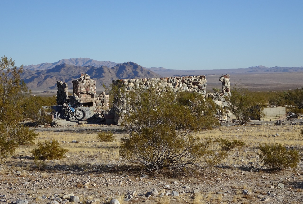 I continued on the jeep road which meanders across the plain towards Rattlesnake Canyon, which starts in line with the road's trajectory in the pic  Rattlesnake is one of only two sections of route I hadn't scouted. I tried to ride it on the moto the previous fall but the sand/gravel was so deep and soft I couldn't keep the bike upright and gave up within a half mile of entering the wash. It was much better today. I was able to pedal much of the section where the moto had had trouble.  Rattlesnake Spring is near the bottom of the canyon. Lots of water but didn't look very appealing. There was a bit of water trickling in from a pipe at the far end, but the locals weren't budging. I continued on.  Beyond the spring it was tough sledding. Even with tires aired way down, I had to walk a lot.  I didn't mind, the scenery improved the higher I got with Joshua trees appearing first along with rock covered canyon walls, and then pine trees.  I was able to ride short sections of the wash, but it really wasn't worth the effort.  I knew there was a spring higher up in the canyon that flows year round, but it was still cool to see when I got there. The first sight of it was pools of water among rocks right in the road. Fall colors that emerged a bit higher up were even better. There was even a bit of ice in shaded spots and a patch or two of leftover snow from whatever storm hit last. Made me glad I was going to get through here before the incoming storm.  The wet section of trail lasted for 2 miles with water flowing intermittently down the road or beside it. The moisture made this entire section rideable. And then it was back to pushing for the last couple miles to the top.  At the top you are greeted by a forest of impressive Joshua Trees, with some nice campsites scattered around both sides of the road  It was almost 2pm by the time I got up top, so I didn't linger. I'll have to go back and explore further some time. I was surprised how much private property exists up top. Starting 1/2 mile beyond the campsites most of the descent to Yucca Valley runs through private property, with residences dotting the landscape.  Burns Canyon was a long section of private land. Lots of houses up top, then a fast descent down a surprisingly rough road in the canyon.  I wasn't a fan of the road below Pioneertown. It was paved and narrow with minimal shoulder and lots of traffic. Fine going downhill as I was, but it would be super sketchy to climb. I came back after the riding loop and found another way. Yucca Valley is a major resupply and I planned to stop there, but missed the turn onto a side road that I had mapped out and ended up on Hwy 62. That turned out ok because the road is wide with a bike lane most of the way, and it has great access to stores and restaurants. I hit up a taco shop for a carne asada burrito for dinner and a breakfast burrito for the next day. Rather than drop down to Yucca Trail / Alta Loma Road as planned, I just stayed on Hwy 62.  It had awesome views of the mountains to the south.  By the time I stopped to eat my burrito and grab snacks at a grocery store, it was getting dark. Pic taken around 530pm. Riding through JTree by moonlight has been on my bucket list and this was the night. 35 miles to get through the park to where you can legally dispersed camp in Berdoo Canyon. I probably could have gotten a spot at a campground in the park since this was a weekday, but I wanted to make more miles since the first half of the day had gone so slow.  Riding through the park was awesome. This was the Full Beaver supermoon and it was right overhead all evening, so it was as close as you'll get to daylight out there. * Pics taken using night sight feature on my phone.  I was stopping a lot to check out the sights so I wasn't making great time.  And I wasn't the only biker out there riding around. There were a few hikers out too. Highly recommended!  The route turns onto Barker Dam Road to Queen Valley Rd and Big Horn Pass to get to Geology Tour Rd. It was getting chilly here and there was a long descent coming up so I had a snack and put on some layers.  There was a 5-mile, 1,000ft climb out to the top of Berdoo Canyon that helped warm me back up. Then a chilly descent in the canyon. The wind had picked up a lot for the last hour or so and I was hoping that the deeper part of Berdoo Canyon would offer some protection. It didn't. But I found a somewhat protected spot soon after crossing out of the park and was soon crashed out despite the moon still being bright overhead.  Stats for Day 2 - 76 miles, +5,800 / -5,200ft, 16hrs |
|
|
|
|
 Logged
|
|
|
|
 Topic Name: New bikepacking route and TR - Desert Solitaire Topic Name: New bikepacking route and TR - Desert Solitaire
|
Reply #3 on: December 13, 2024, 11:45:08 PM
|
evdog
Location: San Diego
Posts: 387

|
 |
« Reply #3 on: December 13, 2024, 11:45:08 PM » |
|
Day 3 My campsite in Berdoo Canyon. The rise on the right provided some wind blockage. Fortunately it was calm by morning.  Got up and going decently quick. Berdoo is a pretty fun descent with lots of turns and a few rock gardens. I was camped not far above the target shooting area so it wasn't far to get out.  It's easy on a bike.  Came across a fresh stolen vehicle a couple turns below. Took down the plate number to call it in. A couple turns further and I came across a couple BLM law enforcement officers in their truck. They were waiting for a tow truck to get it out of there. Talked to them for a few mins. They claimed they might see me later on the Bradshaw Trail. Doubt it. I think this was the first time I'd ever seen a BLM LEO in the wild.  Next it was time to hit pavement for a little, down Dillon Road and then up Fargo Road past a number of cement and aggregate plants. Fargo was busy with trucks. Between that and the following section of aqueduct road this is one of the sucky sections of the route. 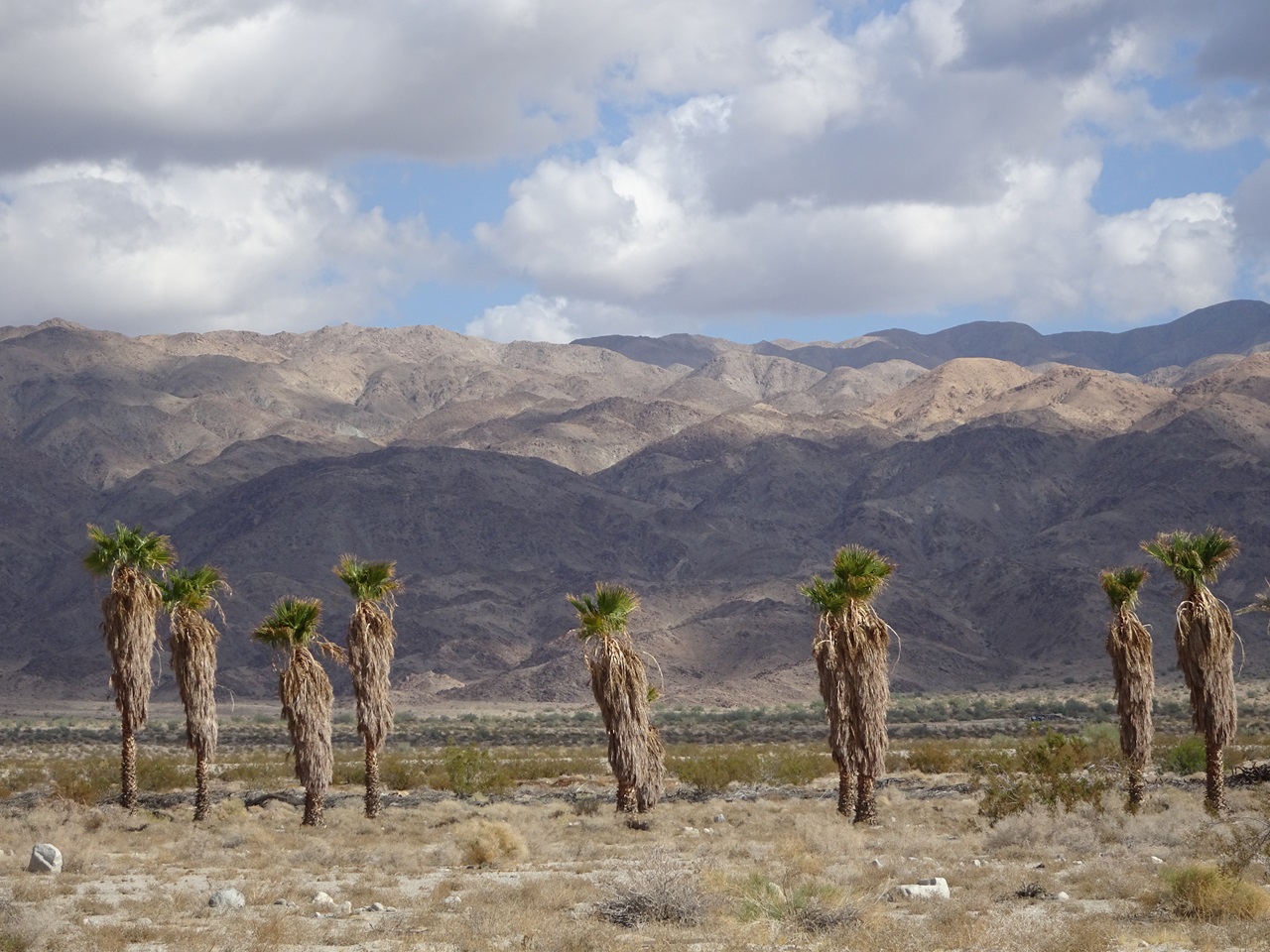 I had planned to do a bit of extra scouting on this ride, checking out some alternatives I had not been on before. There is a section of aqueduct road that is extra sucky with deep sand and loose rock. So I started up a promising looking jeep trail that parallels it. It started off great, then there were a series of steep rocky gully crossings, and then it turned into deep sand with lots of rock. Not better than the original route. And since I was pushing anyways, I just turned north and pushed cross country for a half mile back to the aqueduct road. The bad section of aqueduct road only lasts for a mile, so people will have to suck it up.  I tried another side route a few miles later that was much nicer. The aqueduct road is mostly just a typical graded dirt road. This side road, West Double Canyon road, was narrow doubletrack with pretty good tread. Win. Another side road just after this turned out to be mega steep hike a bike up, and then just as steep hike a bike back down. Lose. The good stuff:  I knew Thermal Canyon would be a slog especially considering how dry it was. I did a fair bit of pushing, and it took a while.  It is definitely worth it though, it's really nice back there. Thermal Canyon heads north, and then you turn east and ride across Pinkham Canyon, a remote back canyon that sees little traffic. I didn't see a single person on trail all day. Side note - there is an old trail which starts at the top of Berdoo Canyon and drops down to the top of Thermal Canyon. It is shown on google maps and other apps as "Thermal MTB trail". Unfortunately the park has it listed as closed to bikes. It does not pass through any designated Wilderness area. It would be bad ass to get this re-approved for bike use.  It was late afternoon by the time I made it through Pinkham Canyon.  I topped up water at Cottonwood campground and then headed down out of the park.  It wasn't quite sunset yet but looked like it with the clouds.  More tanks. The General Patton museum is at Chiriaco Summit on I-10.  Apparently you can go for a ride in one of them. I was mostly curious where they would drive them. I had a burger at the restaurant, charged my electronics, and picked up some food at the gas station.  It was well past dark by the time I got out of there, but the moon was just coming up. From Chiriaco Summit I hopped right onto dirt as soon as I crossed I-10, and then picked up the Red Canyon jeep trail. I was just planning to ride Red Canyon to the start of the Bradshaw Trail, so didn't really have far to go - 12 more miles.  Red Canyon is pretty cool so I spent time again checking out the sights. The trail follows a ridgeline above the canyon for a few miles before dropping down into a wide wash. I had to turn lights on for some parts of the descent but rode most of it by moonlight again. In addition to being cool it was also conserving battery power!  Aside from a few short steep pitches, it's a really fun ride.  The Bradshaw trail is down in the wash. I didn't want to camp in the wash, but Bradshaw leaves the wash after a couple miles so I decided to finish that part up as well. Soon after it climbed out of the wash I found a flat spot nearby which was my home for the night. Winds were calm and it was super quiet.  Day 3 stats - 61 mi, +3,900ft / -6,100ft, 13 hrs |
|
|
|
« Last Edit: December 14, 2024, 12:06:15 AM by evdog »
|
 Logged
|
|
|
|
 Topic Name: New bikepacking route and TR - Desert Solitaire Topic Name: New bikepacking route and TR - Desert Solitaire
|
Reply #4 on: December 14, 2024, 04:07:04 PM
|
evdog
Location: San Diego
Posts: 387

|
 |
« Reply #4 on: December 14, 2024, 04:07:04 PM » |
|
Day 4 Camp next to the Bradshaw Trail For anyone wondering what the box is for, I wanted something to hold the MSR dromedary upright, so I cut/taped a box to form fit it when full of water. Otherwise it slumps sideways and is otherwise a PITA to deal with inside a backpack. The box worked pretty well and I could stuff clothing or food it in when the dromedary was empty.  I was woken up by some hunters rolling past on ATVs just after sunrise. Another one came through as I was packing up and turned south off the Bradshaw trail into the military reservation (Chocolate Mtns Aerial Gunnery Range) which is heavily signed warning of unexploded ordinance. You do you, buddy  This was my view for much of the first half of the day. The road is fast rolling with distant mountains on both sides - Chuckwalla Mountains to the north and Chocolate Mountains to the south.  The Poopmobile marks the high point of the Bradshaw Trail at 2,500ft  Another junked car well off the road  There wasn't much wildlife but I did spot this guy, and shoo'd him off the road  This is Munz's Cholla, which grows only in this area between the Chuckwalla and Chocolate mountains. It is the largest cactus in California aside from the few wild saguaros that exist near the Colorado river.  There's not a lot of shade on the route, but you can sometimes find it under ironwood, palo verde and smoke and mesquite trees at wash crossings. Wash crossings were also the only spots where I encountered deep sand, usually for a short distance  If cars weren't enough there are a couple boats out there. The Covid 19 boat is probably not sea worthy with all the bullet holes  The mountains got closer and cooler looking the further east I rode. The road also got a bit sandier but still rode pretty fast overall. It helped that the Bradshaw trends downhill, though you can't really call 1,800ft over 30 miles a descent. But it definitely helped.  More cool mountains  I got to the turnoff for Wiley's Well, which has a campground with a well, and a long term visitor (camping area) to the south. The water at Wiley's Well is considered unfit for drinking due to heavy mineralization. With the cool temps I had not been drinking a ton so I had plenty left. The route turns south here for a few miles on a main BLM road before turning off onto a narrow jeep road that heads up to Opal Mine Pass.  This was the best alternative I found to the ending of the Bradshaw Trail, which has deep sand east of Wiley's Well and then pavement all the way to Palo Verde. Opal Mine is a definite upgrade from that.  Dropping down the other side  Looking back I realize maybe I should have hung out at the pass to watch the sunset. Oh well.  This sums up my feelings about bikepacking  There is a short steep hike a bike to get onto a ridge, and after dropping off the ridge there is a long pedal across the desert to Palo Verde  The moon wasn't up yet so lights went on before town. I stopped in at Wheelie's Mini Mart (Chevron) for snacks and drinks. No one there was sure if the only local food place - Karlz' Sand Shack - was open. But I had enough food regardless and it's right on the route, so I'd soon find out. There were people there when I arrived but it looked like they were shutting things down. I asked, and they offered to fire up the grill again and make me a burger. Score! It's a small spot with a BBQ, a few tables and a one-room store that has limited hours. This was a Saturday. I'd forgotten about the time change crossing the Colorado into Cibola AZ, and they had just closed at 8pm. Burger was great, and only $6! Huge shout out to Karlz's!  Found my next destination on the sign, the Arizona Peace Trail.  After a few miles on the AZPT I made a turn and took the cutoff to the Oxbow Road along the Colorado River. AZPT isn't anything special in this area and passes through the Yuma Proving Ground where you aren't allowed to camp. So routed Desert Solitaire along Oxbow Road next to the Colorado River instead. There are plenty of dispersed campsites and as a bonus during hot weather, there are a few spots where you can swim. I rode about 12 more miles to a campsite I had in mind, which was open. The moon had come up as I was at Karlz' so I did much of this again by moonlight.  Stats for Day 4 - 82 mi, +1,800ft / -3,000ft, 13.5 hours |
|
|
|
|
 Logged
|
|
|
|
 Topic Name: New bikepacking route and TR - Desert Solitaire Topic Name: New bikepacking route and TR - Desert Solitaire
|
Reply #5 on: December 15, 2024, 12:24:34 PM
|
evdog
Location: San Diego
Posts: 387

|
 |
« Reply #5 on: December 15, 2024, 12:24:34 PM » |
|
Day 5 Sweet campsite on an oxbow of the CO River. It was super quiet except for the waterfowl that started squawking before sunrise  I had a short ride on the river before the route turns away. The road I had used for the route was now 8" of silt so I found another way to connect to the powerline road. Once on that, it's easy pedaling except for a few wash crossings  Random BBQ and table just off the road. It's a bring your own wood situation, so not much use for bikepackers.  The powerline road is surprisingly nice riding as it meanders in and out of shallow canyons, often away from the powerline. After a few miles the route rejoins the AZ Peace Trail  Once it turns off the powerline road, the route gets really nice - narrow jeep trail passing through a rocky canyon  Saguaros make an appearance  There is a wildlife drinker in the canyon. It was dry last year when I scouted this section. This time, there was a new plastic tub with water being piped in from a tank. This was the only drinker I checked that had any water on this ride. FWIW, I would not rely on any of these sources. They may have more water in spring, but even last March many were dry.  This segment of AZ Peace Trail is referred to by offroaders as The Good, The Bad, and The Ugly. I think this section is The Ugly (for them). It was a quick hike a bike with a MTB  After finishing that section it was back onto powerline road. There are two side roads I had included in the route. After riding the first one again I decided to nix it from the route - too rocky and loose, not worth it. The second one which takes off from the graded patch in the pic below, is great  Nice narrow jeep trail that rides well  Once out of the canyon it's an easy pedal across open desert to the La Posa long term visitor (camping) area south of Quartzite. The LTVA is 5 miles of flat riding with wide open space for RVs to camp on both sides of the road, segmented into sections by brush filled washes.  Amusing... and doubles as a bird nest, I hope  I made it in to Quartzite and headed to the Discount Grocery & Drug store south of I-10 for resupply. Not sure what their deal is but it seems like they buy a lot of overstock type food and goods - almost all non perishable and sort of an eclectic selection, but their prices are really good. You'll have to go elsewhere for fresh fruit and produce. Then I headed into town for tacos.  There is a bike path heading out of town that goes all the way to the AZ Peace trail. The first seven miles are regular dirt road, then you turn off onto jeep road. It was golden hour by this point and the mountains and lighting were spectacular.  Best time of day  Looking back. I love these meandering desert roads   There a bit of a climb up to a high point, not sure I'd even call it a pass. And then the route trends downhill into town. Which helped as it gets a bit sandy in places  Last light  All the restaurants and the general store in Bouse were closed but Family Dollar was still open, so I resupplied there. I generally despise dollar stores because they are mostly private equity owned chains that kill local businesses, but for bikepacking they are great with low prices and open late. I wanted to get some more miles in and the moon was just coming up, so I headed out of town. Crossing the Arizona Central canal. No water access, unfortunately.  I made it almost 15 miles. A cattle tank that had water last spring was bone dry and the fence around it torn down, so I think that one is no longer being maintained. I went a mile or so further and found a spot to camp a ways off the road. My feet had been feeling the effects of long days. Those aren't blisters, but skin that's been affected by moisture for too many hours. I had brought an extra pair of riding socks so the plan was to alternate pairs a few times a day to help keep the feet dry. It worked...sort of.  Stats for day 5 - 74 miles, +3,800 / -2,700ft, 13 hours |
|
|
|
|
 Logged
|
|
|
|
 Topic Name: New bikepacking route and TR - Desert Solitaire Topic Name: New bikepacking route and TR - Desert Solitaire
|
Reply #6 on: December 15, 2024, 11:08:10 PM
|
evdog
Location: San Diego
Posts: 387

|
 |
« Reply #6 on: December 15, 2024, 11:08:10 PM » |
|
Day 6 Yes that is a full size wool blanket. I added it to my pack last minute and was really glad I did as the 30* bag was barely cutting it even with all my layers on. Maybe I'm just getting old, but I can't sleep well if I'm cold. The bivy sack often gets some condensation so I took a bit of time to dry everything out before riding.  The section I had ridden last night isn't very interesting so it was no big loss riding it at night. The next section towards Planet Ranch has much better scenery. 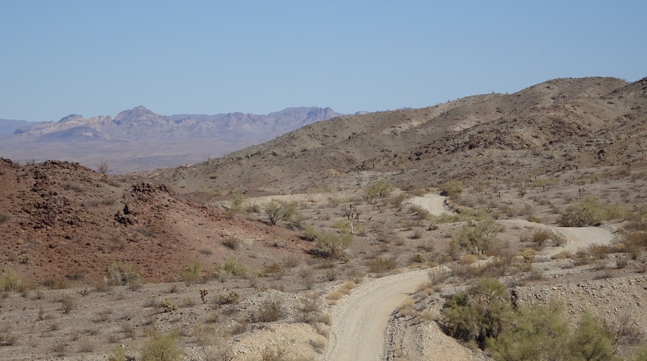 Cholla forest  I liked this lone saguaro on the next hill  And some dramatic rock formations next to the road  The only sign of life out there 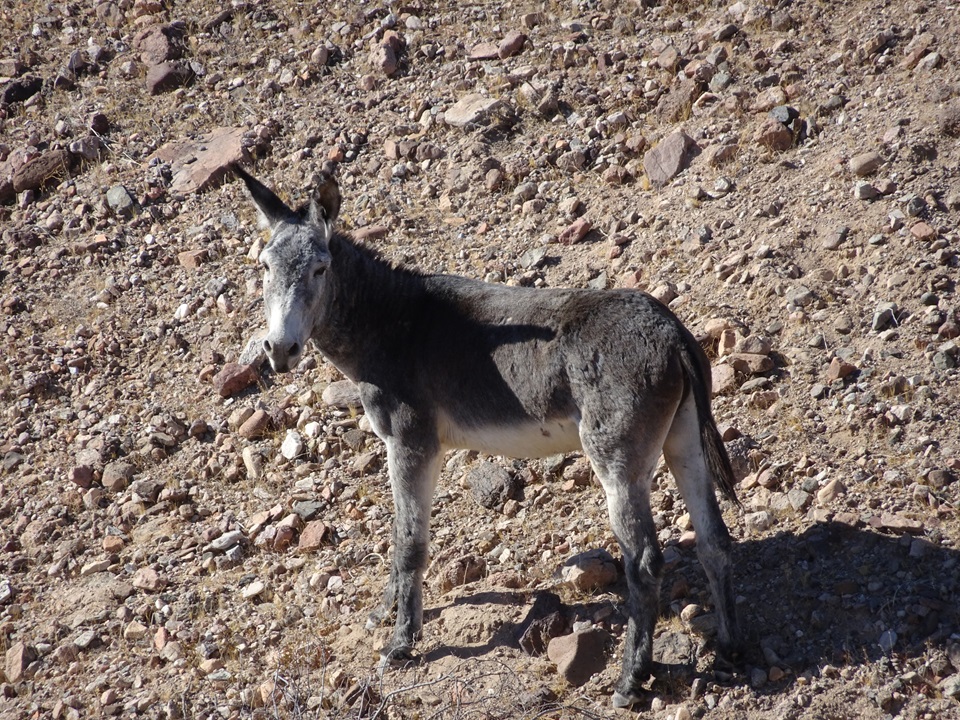 The terrain was really interesting and varied with good views to distant mountains 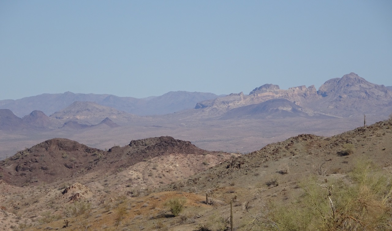 Since the dry cattle tank the night before, the road had been a bit narrower and sandier. It dropped into a wash as I began the descent into Planet Ranch, and ran through a narrow canyon  Contrary to the name, Planet Ranch never appears to have been an actual ranch. Instead it was a historic mining town called Planet with a number of mines including the Planet Copper Mine, one of the top producing copper mines in the country at the time. The property surrounding town became known as Planet Ranch after coming under ownership of the Arizona Ranch and Metals Company. It was later purchased by the City of Scottsdale thinking they could use the water rights to support the city. Mining company Freeport McMoRan acquired it from Scottsdale, leased it to the US Bureau of Reclamation, and then gave the land to the AZ Dept of Fish and Wildlife. US BoR now administers the property as part of its Lower Colorado River Multi-species Conservation Program. The only public access to the property is the road which runs through it. So, keep pedaling.....  There is a short climb from the wash (aka Bill Williams River) up to a plateau above the ranch. The road, now wider and graded, continues its very gentle climb across the plain before the route turns off onto a nice jeep trail.  After some more climbing the jeep trail drops into a wash for a couple miles of misery. No way around this one without a long re-route, which would undoubtedly involve its own wash riding.  At least the scenery was cool. That is Castaneda Peak  A bit more climbing out of the wash brought be to a high point. The descent started off loose and rocky  But soon eased up  These few miles was one of my favorite sections of the whole route  Mojave yucca  The section of wash that followed was a non-favorite. But the singletrack at Sara Park by Lake Havasu made up for it.  The route follows the western half of the Watershed loop clockwise, starting from High Voltage  I resupplied on the way through town and then hit up Filiberto's for tacos. The dining room was closed but the drive thru is open 24/7 : )  Ate my dinner at a bench next to the London Bridge  I had now missed both swimming opportunities by arriving after dark, so I opted for a motel room since it was now day six without a shower. I also needed to do some sink laundry and charge my electronics. My feet were so filthy I left footprints when I walked barefoot across the carpet. Fortunately the motel was a dump so I doubt anyone would care, or even notice. Stats for day 6 - 65 miles, +3,200 / -4,100 ft, 13 hours |
|
|
|
|
 Logged
|
|
|
|
 Topic Name: New bikepacking route and TR - Desert Solitaire Topic Name: New bikepacking route and TR - Desert Solitaire
|
Reply #7 on: December 16, 2024, 09:48:38 AM
|
evdog
Location: San Diego
Posts: 387

|
 |
« Reply #7 on: December 16, 2024, 09:48:38 AM » |
|
Day 7 A huge benefit of the motel room is not having to pack up camp in the morning. So I was able to get out of there quickly. After a seven mile pavement ride out of town the route turns onto dirt and I immediately hit deep sand. Between Lake Havasu and Topock was the other segment of the route I had not been on, so I was hoping the sand would not last long.  Fortunately, it did not and I was soon pedaling firm jeep trail towards the mountains. Despite having the track displayed on my GPS I wasn't sure how route was going to get around these mountains.  In the end, it dropped into a wash in front of the mountains and followed the wash for a couple miles to the east. Much pushing ensued.  I had a steep (for this route) climb coming up soon after exiting the wash. Most of the climbs on the route are across open desert with very gentle grades. This was an access road to a ridge top powerline road. Looking east near the top of the climb.  I got a bit of a descent down the other side, and then the route traversed across the top of the ridgeline for a few miles before starting the descent back to open desert.  There were some interesting spots, like where it winds around these rocks in a wash  I see an alligator with an arch for an eye and forehead, laying on top of a mound. Maps call it Hole in the Rock.  Not far beyond that I turned left and soon came across an unofficial looking sign that said Do Not Enter - Open Excavation. I could have gone back and continued north but couldn't tell if there was a way to cross I-40 later. I couldn't hear any equipment working, so I rode ahead. Eventually I found where they were working, just a loader moving dirt. I spotted a jeep trail that turns off the road just before the work site. Satellite seemed to show it going where I needed to go, so I took it. And it was much nicer than the graded road I'd been on, following the top of a ridge for a couple miles. Win.  It eventually dropped into a sandy wash in a narrow canyon. But the sand was fairly deep so it involved a bit more pushing than I'd like. The jeep trail had split before dropping into the wash and it looks like the other option would involve less wash riding. I'm going to use that for the route.  Exiting the wash there was a short pedal to I-40. I passed an A-Dot maintenance yard on the north side and then picked up more dirt that led down to a railway bridge over another wash. Perfect timing, as a trail was approaching  Looking back at the mountains in the Havasu Wilderness just west of where I'd ridden.  I crossed under the railway bridge and started up a wide wash. The route soon turned off that onto a side road that followed along the base of an 1880s railway grade.  The road would turn right just out of sight in the pic below and the sand got soft and deep. Rather than go that way, I'm going to have people push up the steep climb you can see top right in the photo. It takes you straight up to the firm mesa top and avoids the worst sand in exchange for a minute of hike a bike.  There are a few twists and turns after that, before the route hits Oatman Highway just south of Topock and Golden Shores. There are some restaurants and stores there so I picked up some snacks before continuing on. There is a seven mile pavement pedal on Oatman Highway, aka Hwy 66, heading out of town.  With almost no traffic it was a nice break from the sand and washes. And pretty scenic in the golden hour light  Caught a nice sunset along the way. I'll be climbing over those mountains tomorrow!  The route turns onto a powerline road which it follows for six miles. It was pretty nice riding, and the sunset didn't hurt.  The road tread was mostly pretty good. And there were enough turns and rocks to keep it a bit interesting.  I spotted a trail sign next to the road for a hike/bike trail. I never would have identified it as a trail without the sign. It looks like an abandoned railway grade, but pretty narrow. No evidence of any use above or below the road. Unfortunately it went in the wrong direction for me (southwest) or I might have checked it out.  Right now I have the route climbing up a jeep trail back to Oatman Highway and then going through Oatman, before dropping into Times Gulch. I had never been on the rest of the powerline road and wanted to see what it was like. It is the more direct way to go, connecting to the route where it exits Times Gulch. This would also get me into Fort Mojave before all the stores closed as I needed to resupply. Turns out the rest of the powerline road isn't great. It crosses some larger ridges so there is a lot more climbing and descending in and out of gullies, and it gets rockier which led to a lot more pushing. So I think I'll keep Oatman on the route. It's a cool spot if you hit it during the day. Not much to see there at night. I made it into town in time to do my resupply. The taco shops were all closed so I hit up Pizza Hut next to Safeway. There is no camping until you get past the Fort Mojave Indian Reservation west of the Needles Hwy, so I still had a little ways to go. The moon was up again, so once I turned onto the Mojave Road I was able to ride lights out again. I don't think I'll ever get tired of that. Looking back at Fort Mojave.  I went a few miles up beyond where any boondockers were camped and out of view of the lights of town, and found a spot off to the side of the wash. Another great day out there. Day 7 stats: 65mi, +4,600/ -4,000 ft, 15.5 hours |
|
|
|
|
 Logged
|
|
|
|
 Topic Name: New bikepacking route and TR - Desert Solitaire Topic Name: New bikepacking route and TR - Desert Solitaire
|
Reply #8 on: December 16, 2024, 11:40:26 PM
|
evdog
Location: San Diego
Posts: 387

|
 |
« Reply #8 on: December 16, 2024, 11:40:26 PM » |
|
Day 8 Riding near the border of time zones always seems to screw me up. My phone often can't seem to figure out which one it is in, and likes to switch zones unnoticed. It had done this to me a few times while riding the AZ Peace Trail near Quartzite and again near Lake Havasu. And when I woke up this morning it took me a few minutes to realize it was back on AZ time while I was geographically in pacific time. So I had gained an hour but my phone was telling me I had slept in. Leftovers for breakfast. I'd have to carry the box as I wouldn't have trash service until end of day at least.  The Mojave Road in this area follows a wash almost all the way to the top. The sand wasn't so bad lower down but gets worse after you round this hill. I had spotted some moto singletrack on satellite that provides a nice bypass to the upper half.  The trail had seen a bunch of traffic since I scouted it in March, but was still riding a lot better than the wash  I wish there was more of this out there...and maybe there is! You never know what you'll find in the desert.  There are two singletrack segments separated by a section of powerline road. It all rides pretty well. There is more singletrack in the area but it has diminishing returns in the form of hike a bike if you want more miles. Motos like their steep climbs. By the time the singletrack meets up with the Mojave Road you are up top and the road is nice hardpack with some fun dips and turns  And a nice view of what's to come on the other side of Hwy 95. The canyon in the distance is where Fort Piute and Piute spring are located. That's one of the few guaranteed reliable water sources on the route. The original Mojave Road used to go right up this canyon. And there is still a marginally passable trail to the top. But it is now in Wilderness and off limits to bikes and vehicles. The current Mojave Road sidetracks a couple miles to the south and goes up an adjacent canyon outside of Wilderness. At 30mi from Fort Mojave and 37 from Hole in the Wall campground, Piute spring splits that segment perfectly for water. But given the cooler temps, I planned to skip it and carry enough to get to the campground. Fort Piute and Piute spring are a couple miles off the Mojave Road. It's worth stopping at if you've never been there. And especially worthwhile for water if it's hot out.  What is it with abandoned boats in the desert?  Creepy abandoned house and RV just off the Mojave Road  You might think the AZ Peace Trail is a sh*t show of SXS and OHVs but it really wasn't. I saw just a few each day and they were mostly just cruising around sightseeing. The only people I'd been dusted out by were a trio of Broverlanders in Toyotas near the Bradshaw Trail who were driving on a BLM road like they were in the Baja 1000. That said, I still prefer riding areas like this where only street legal vehicles are allowed. Even if they aren't charging it like the Toyotas, OHVs still put tracks everywhere including a lot of places they're not supposed to.  I had the second "big" climb of the day today coming up, a proper climb of about a thousand feet in three miles up to Lanfair Valley. Nice views to enjoy on each side during the climb  Lanfair is pretty flat. It's more typical desert climbing with 1,200ft gain over the next 15 miles. And mostly good tread.  The mountains were distant but seemed to provide a destination to aim for, and slowly they got closer as I pedaled  And the more I pedaled the more Joshua trees appeared on the landscape  I mentioned Mojave Yucca a while back. They are a different species from Joshua Trees. That's a Mojave Yucca on the right with longer leaves that have white threads that hang off their edges. They are usually shorter and can have branches lower down on the trunk. Joshua Trees like the one in the middle often have more trunk before branches start. And shorter leaves.  Despite the steady climb I was enjoying the ride.  But with most of the day trending uphill I hadn't made great time. It was getting on towards sunset and I'd done just over 30 miles.  Stopped to drop a penny at the penny can tree  I knew it would be colder up here but the temps were dropping a lot faster than expected. It had been 60 earlier and had quickly dropped into the low 40s as the sun started to set  I stopped at the Nevada Southern monument to add layers. Most of them, in fact.  Temps continued to drop, now showing low 30s. I had ridden at least a few hours in the dark every night so far, but it was not going to happen tonight. The wind had picked up a bit and had a cold bite. I had to pull my buff up over my face and ears, and stopped to add another layer. It was ok for now as I was still climbing. But the route turns off the Mojave Road soon and drops into a couple drainages. I figured those would be even colder. I was on the lookout for a campsite that was flat and had a bit of wind protection. By the time I found one temp was showing low 20's. Oof. The last forecast I'd looked at for this elevation had said mid 30's. This was the night I was really glad I'd packed that wool blanket! And the stove... Fired it up and cooked some some ramen from the comfort of my bivy sack. Then it was lights out. It was early enough the moon wasn't up yet. It was nice to sleep in actual darkness for once. Despite the cold I slept really well.  The low mileage was a bit disappointing compared to other days but not surprising given the uphill nature of the day and having to stop early. The route beyond this point is a lot faster so I probably could have clocked 20+ more miles had I been able to ride a few more hours. And I would have done that, had it been warmer. Stats for day 8: 42 miles, +4,400 / -800ft, 11 hours |
|
|
|
|
 Logged
|
|
|
|
 Topic Name: New bikepacking route and TR - Desert Solitaire Topic Name: New bikepacking route and TR - Desert Solitaire
|
Reply #9 on: December 17, 2024, 07:53:44 PM
|
evdog
Location: San Diego
Posts: 387

|
 |
« Reply #9 on: December 17, 2024, 07:53:44 PM » |
|
Day 9 I am a night owl who usually goes to bed at 1 or 2 am. When I go to bed early I usually wake up early. So I was awake for the awesome sunrise. But quickly got back in the bivy. It had warmed up a bit to the low 30s overnight but that was still too cold for my weak socal ass to get up.  I took my time getting ready and the sun was fairly high by the time I got going. The Mojave Road goes through Cedar Canyon in this area, but does so as a wide graded road which is out of character for the Mojave Road and the route. I found a primitive jeep trail that heads south from there and crosses over near Hole in the Ground campground. Part of the goal was to avoid the wider road, and part was to hit the spigot at the campground since the Camp Rock spring on the Mojave Road is not reliable.  The jeep road zig zags in almost every direction while passing through a really scenic area. It doesn't see much traffic. It drops down a bit before climbing out of a small canyon and then dropping down to Hole in the Wall. I like it.  From there the route picks up Wild Horse road which loops around to Mid Hills Campground, the second highest point on route at 5,600ft.  After attaining that high point it was easy riding for most of the day. Dropping down to Kelso-Cima Road there was a great view of Kelso Dunes in the distance  I had a snack break and removed some layers at the Mojave Road monument at Kelso-Cima Rd. You can see the upcoming route meandering in the distance  This was the only real climb for the day, about 900ft in nine miles. A pretty easy climb on good road.  There were a few steeper pitches, mainly climbing out of Marl Spring. Marl was flowing pretty well but since it flows right along the ground it would be a pain to collect water from. Maybe worth it if hot? From Hole in the Ground to the water crossings in Afton Canyon is 80 miles which is a long carry if hot out. You can shorten that a bit by going 8 miles off route to Baker or 5 miles off route at Rasor Road.  There were killer views from the route up here  Pencil cholla, not one I see often  The Mojave Road Mailbox marks the top of the climb. I opened it up to sign the log book and found a Pacifico can inside. Score! I'll take it.  Speed picked up from there as the route trends downhill for the next 30 miles.  The route gets a bit sandy again as it crosses Aiken Mine Road, but it is still very rideable. And there are some designated camping sites along the edge of this lava flow. Not far beyond this the Mojave Road drops into Willow Wash which has notoriously deep sand. Fortunately there is a great bypass for it, turning right and going around a cinder cone which is the source of much of the lava flow in this area. There are some even better campsites up against the lava flow on that side.  This bypass brings you back to Kelbaker road a few miles before the end of Willow Wash. You can ride the wash if you want, but I don't recommend it unless you're on full fat tires. I've read it is not uncommon for even 4x4 vehicles to get stuck in it. I started out scouting it and promptly turned around - not worth it on 3.0 tires. Instead, bail onto Kelbaker road for a couple miles to where the Mojave Road crosses.  There is a bit of sand right after the crossing but it soon gets better, still trending "downhill".  I enjoyed a nice sunset pedaling towards Soda dry lake. Make sure to confirm it's open before heading that way. There is a sign just after leaving Kelbaker Road that will confirm open/closed. If closed, you'll need to bypass it via Baker. The consolation is (an expensive) hot dinner and access to resupply.  There is a second sign at the start of Soda Lake in case you missed the first. The Soda Lake is dead flat across for 5 miles and rolls pretty fast.  I was across and at the Traveler's monument in just over 20 min. There is a plaque on top of the monument to read once you're there. Don't tell anyone what it says though. Only people who have visited are allowed to know : )  Some of the worst sand on the route is just west of here. This is a section I scouted on my dual sport moto and I could barely keep the bike upright in places. It gets a lot of blowing sand so vehicle tracks can be obscured. In addition to rock cairns marking the route there are also tall wooden posts in this area. I was expecting a slog, fortunately it was a lot more rideable than it had been last spring. That's not to say that I made great time, because I didn't. But I kept up a steady pace.  The closer I got to Afton Canyon the more riding I was able to do. I always have trouble following the Mojave Road near the start of Afton Canyon because there are a ton of criss-crossing side routes, so I stopped for the night once I got close. Afton is worth riding through in daytime for the great views. I found a nice spot on flat sand next to the road and set up for the night. It was 20* warmer so I enjoyed the Pacifico from the mailbox and a hot meal.  Stats day 9: 81 miles, +3,200 / -6,600ft, 14 hours |
|
|
|
|
 Logged
|
|
|
|
 Topic Name: New bikepacking route and TR - Desert Solitaire Topic Name: New bikepacking route and TR - Desert Solitaire
|
Reply #10 on: December 17, 2024, 09:27:54 PM
|
evdog
Location: San Diego
Posts: 387

|
 |
« Reply #10 on: December 17, 2024, 09:27:54 PM » |
|
Day 10 Final day! I had no need to be in a hurry but also wanted to get the ride over with. Had ramen for breakfast, because why not. Packed up and rolled out.  This time I had no trouble finding a good path through and was soon at the entrance to Afton Canyon. This bridge crosses the Mojave River. A year ago there was (a little) flowing water here. It was looking pretty dry today. I had about 2L of water left.  A mostly buried boxcar. Apparently there are more, but this is the only one I've ever spotted.  Getting to the cool part of Afton Canyon  Lots of sediment types and colors in the canyon walls.  The lighting made it look like there could be a slot canyon here, but it didn't go anywhere  I caught sight of these guys streaking across the wash as a train approached  This rail line sees heavy traffic. You're guaranteed to see a train or three in the canyon.  Looking back  I skipped Spooky Canyon since I've checked it out before. It's a worthy stop. Bring your headlamp with you. And be prepared for a bit of rope climbing.  I just missed catching this trail at the first water crossing and rail bridge which was about 500ft away.  The crossing was dry! First time I've ever seen that...  The second crossing was dry as well. It was kind of a let down. I forgot to check if the spigot at Afton Campground had water. Reports have been mixed from years past and I couldn't find any recent reports. If any of you happen to pass through by bike or vehicle, please check for me!  Next up was the part I was not looking forward to...Manix Wash. Miles of sand. I was able to find a bypass for about half of it, including the worst part. But the route is still in the wash for six miles.  The route through the wash has numerous braids and I was able to find rideable lines for some of it. At other times I just got off and pushed.  I diverted the route onto a BLM road that climbs away from the wash up to the railroad tracks. The sand in Manix beyond this turnoff was pretty brutal.  The bypass follows the tracks for a couple miles of fast rolling road.  This is where the Mojave Road route joins the powerline road. Don't follow this sign unless you like deep sand!  Final miles were on powerline road. Not super nice, but it all rode well. Back to where I started. Done! I had only a six mile cool down pedal back to my parking spot. I had messaged the owner a couple times to let him know what time I'd arrive since he has dogs on the property that need to be chained up. Then it was off to get food.  Stats for Day 10: 33mi, +1,300 / -500ft, six hours |
|
|
|
|
 Logged
|
|
|
|
 Topic Name: New bikepacking route and TR - Desert Solitaire Topic Name: New bikepacking route and TR - Desert Solitaire
|
Reply #11 on: December 25, 2024, 07:31:30 PM
|
offroute
Posts: 327

|
 |
« Reply #11 on: December 25, 2024, 07:31:30 PM » |
|
A true adventure...no motor, no sag wagon, no guide. Pure bikepacking.
|
|
|
|
|
 Logged
|
|
|
|
 Topic Name: New bikepacking route and TR - Desert Solitaire Topic Name: New bikepacking route and TR - Desert Solitaire
|
Reply #12 on: January 10, 2025, 11:18:46 PM
|
ssisyphus
Posts: 2

|
 |
« Reply #12 on: January 10, 2025, 11:18:46 PM » |
|
Holy cow! What a trip!  I've been on portions of this and am impressed with the way you linked it all up. Great pictures and report. Thanks for sharing  |
|
|
|
|
 Logged
|
|
|
|
 Topic Name: New bikepacking route and TR - Desert Solitaire Topic Name: New bikepacking route and TR - Desert Solitaire
|
Reply #13 on: April 11, 2025, 09:25:42 PM
|
evdog
Location: San Diego
Posts: 387

|
 |
« Reply #13 on: April 11, 2025, 09:25:42 PM » |
|
Thanks! I really liked it as well. Pretty good mix of scenery, history, and cruisy desert riding with pretty good resupply options! I updated the route in February to V2.0. First post above has been updated or find the link here: --> https://ridewithgps.com/routes/49784310Will post some pics from the extra credit scouting when I have some time. |
|
|
|
|
 Logged
|
|
|
|
|
|