 Show Posts Show Posts
|
|
Pages: 1 2 [3] 4
|
|
41
|
Forums / Ultra Racing / Re: TNGA 2011
|
on: September 03, 2011, 06:24:07 AM
|
And they're off...  Wish I were out there too. Let's just hope they can all git'r done and safely off course before that storm blows in. |
|
|
|
|
43
|
Forums / Ultra Racing / Re: grand loop
|
on: June 17, 2011, 02:07:47 PM
|
Thanks Dave and Dave. Yep, I sure did ride into Naturita and got a few winks and a shower at the motel there. Along with a rotisserie chicken, a double cheese burger, two breakfast sandwiches, smoked salmon and all sorts of other yummy vittles. I did resist the urge to wheel over to the liquor store for some Nor-Cal mixin's though.  http://nick.zadrozny.com/post/318559399/the-norcal-margarita http://nick.zadrozny.com/post/318559399/the-norcal-margarita |
|
|
|
|
44
|
Forums / Ultra Racing / Re: TD'11 Race Discussion
|
on: June 17, 2011, 01:57:25 PM
|
|
Looks like a good race shaping up! Go Kurt and Jefe! I see Jefe isn't running his standard platform pedals on this one.
Good luck to everyone trying conquer this beast, keep going!!!
|
|
|
|
|
45
|
Forums / Ultra Racing / Re: grand loop
|
on: June 17, 2011, 01:12:56 PM
|
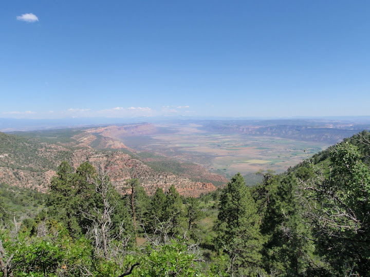
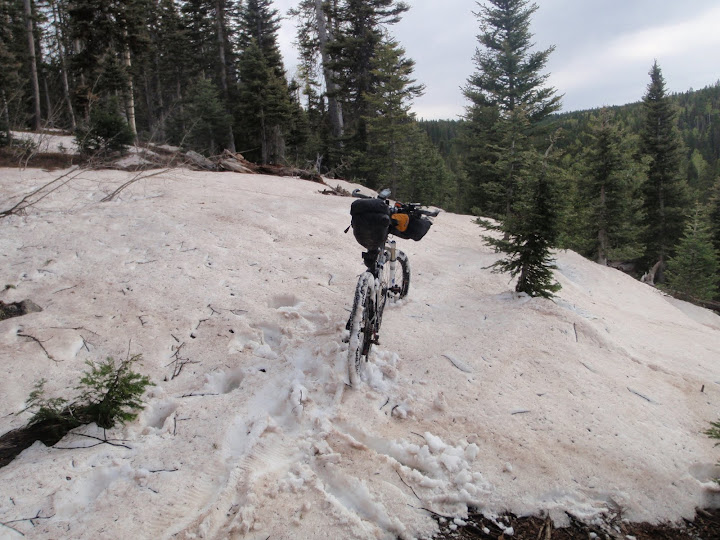
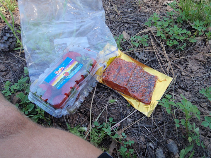
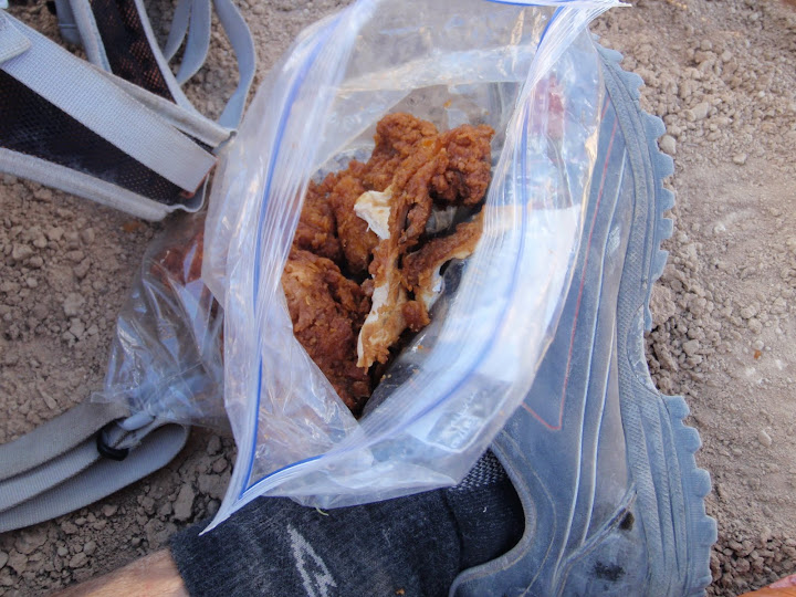
Wow! That was an awesomely brutal ride.  I'm soooo totally smoked. Thanks for all the encouragement! I need a bit of time to decompress and I'll toss up a blog once I get back home but here are some highlights: /* the dirty business */ I started from Dewey at 7:05 pm on Thurs, June 9th and finished 1:19 am on Thurs, June 16th - that puts my time at 6 days 6 hrs and 14 mins. Feel free to double check my math. I'll asterisk this with the fact that I did ride towards Nucla on the Paradox proper, but when I got to Spradlin Park where the pp issue is, there was a truck parked out by that white tank and quite a few ntp (no trespass) signs about. I was unable to make contact with Paul K in Nucla about the issue and felt it proper to just ride back up the road from Nucla (the advised detour) to connect back up to trail on Pinto Mesa, since if it were that someone mentioned that there were 'footy prints all over my desert' (sic.) he - Paul - (and we as mtb'rs) could possibly feel the brunt of any repercussions. I'm all for being loose and free around the edges and such, but... 398 miles 50,193' of ascent /* end */ - Being totally stoked to get started only to be thwarted by the road to Westwater being flooded out, necessitating a last minute change to a Dewey start. (A week later, the water was gone.) - Thinking to myself as I descended Carpenter Ridge - 'Man, I can believe Scott and Chad rode/walked up this thing...' Only to realize my Spot had fallen off somewhere since the top. So I ended up blowing at least an hour walking back up and down to retrieve it. - Almost baking to death on both the Coal Canyon and No Mas Hill sections. I think they lied on the brochure- No Mas Hill ends at Little Park Road.  6hrs to do 22 miles? Insane. - Walking and dragging my bike through all that snow on the Pool Creek section. If I would have not scouted that last fall, I would have been screwed with an unavoidable dnf since there was no way to navigate over/through the snow w/o my track. - Saw five black bears in four encounters, luckily they scurried off quickly. Lots of elk and deer. One cat, but it was too quick for me to make out what it was. Strangely enough, the first bear I saw was just after leaving Hideout. - Making (and then realizing) the same error as my scouting run after riding up Long Creek instead of the 544. - Having lightning crash all around me under a full moon as I did the Fish Ford / McGraw Bottom / Yellowjacket sections. It was eerie, the moon was out in the east and the clouds were pretty stationary in the west. - Being totally DONE when I wheeled into GJ but feeling like a million bucks after a shower/nap in a motel and a trip to the grocer for some sushi, fried chicken and fresh fruit. - Super awesome winds helping to cool me down on the hot cloudless Salty Bitter pill sections of the Kokopelli. The lack of sun really plucked the stinger out of the Yellowjacket as well. - Realizing that the notion of a 'good idea' and 'grand loop' is quite the dichotomy, a Paradox (pun intended), if you will. This course will certainly mess and mangle with your mettle. That said, never say never (again). Maybe once they get that pp issue figured out and there's no snow up high. Here's a quick pic sampling (took 268 of 'em out there). Overlooking Paradox Valley:  Bedrock Store - Closed:  Full Services in Nucla:  Snow on the Pool Creek section:  DH's River:  Good grub courtesy of the Naturita grocer:  Last bits of chicken somewhere on the Kokopelli:  |
|
|
|
|
46
|
Forums / Ultra Racing / Re: grand loop
|
on: June 08, 2011, 11:29:38 AM
|
|
My plan is to start Thursday at ~6pm at Westwater, going through Bedrock. Looking at 4 days and some change? Probably two days to Nucla, then two more to GJ/Fruita and the final push from there on the change. DanNM, check yer messages.
Luckily(?) my friend here in Denver doesn't have internet, so I'll probably only check in once or twice more before the start.
I'll be spotting, there's a link on my blog, linked through my profile.
|
|
|
|
|
48
|
Forums / Ultra Racing / Re: grand loop
|
on: May 16, 2011, 06:49:23 PM
|
|
Yep, that's the site. Lots of good info in there. You should be able to turn on enough landform features (roads, cities, etc.) on the snotel plots to be able to get a decent alignment /* edit */ in TF.
|
|
|
|
|
49
|
Forums / Ultra Racing / Re: grand loop
|
on: May 16, 2011, 03:33:15 PM
|
One awesome thing about TF are the user map overlays.  Snotel hit ground zero today, so hopefully in a few more weeks there won't be any swe spots on the right hand side of the image. Mid-June? Entrada Bluffs in the full-moonlight sounds mighty enticing. CPSC2 is the Columbine Pass station.  |
|
|
|
|
50
|
Forums / Ultra Racing / Re: grand loop
|
on: May 10, 2011, 11:43:00 AM
|
|
From the looks of things on my end (obviously, ymmv), the Unc is looking like mid June before the coast is clear.
DanNM, I'd be all up for a group start but like the conundrum of herding cats goes, everyone is of their own devices with regards to what is passable or not. That said, I'm looking at starting from Westwater and hoping to ride, not walk, the Pool Creek section.
|
|
|
|
|
51
|
Forums / Ultra Racing / Re: 2011 Dixie 200 Planning
|
on: May 10, 2011, 11:39:52 AM
|
Oops, that's raki. Think moonshine made with plums. The double distilled is SMO~O-O-O-V-E!
Nice, Albanian moonshine! Wonder if they have that on tap underground here in the inner-city Daytwa? Sorry for the hijack.  |
|
|
|
|
52
|
Forums / Ultra Racing / Re: grand loop
|
on: April 22, 2011, 04:01:36 PM
|
|
Tradition ticks in six weeks.
The SWE graph is looking good (below avg for this time of year) and without a spring storm, a mid/late May attempt might go? That's my aim and I'll definitely await a window of fair weather in that time frame.
Anyone else still mulling this over? Or been out to scout the new section near Nucla?
|
|
|
|
|
56
|
Forums / Bikepacking / Re: NCT in the LP of Michigan
|
on: February 17, 2011, 10:16:00 AM
|
|
@mmeiser
The gray area isn't so much 'access' per se, although it would be nice to see some of the forbidden sections open up to bikes. No, it's more figuring out a position between the hikers (who for the most part, are building the trails) and bikers. As I mentioned, the tension between use groups tends to be quite high here in Michigan. I know riding around Sheck's Place campground, there are carsonites with clear 'no horses' emblems, but the trails are generally torn up and littered with poop regardless. Between Marilla and Dilling Road is generally an XC rider's dream playground, so you can imagine the reaction of hikers when a biker is hammering out a race pace w/o regard for other users of the trails. Those are just two examples. I'm sure there are many more, especially with hunting and fishing groups, who utilize the land the trails pass through.
@clydeone
Yea, deviating off the NCT 'roadie' course parts to add more valid single track would be a good thing.
Well winter is about to re-emerge here, so I'll probably not make it out to verify some of the roadie sections until the end of the month, but I do hope to have it all done before anyone would attempt to itt the entire route.
So, anyone willing to commit to a start date? I'd say Mid-May at this point. Looks like a full moon on the 17th, so maybe start either the 14th or the 21st?
Jim
|
|
|
|
|
58
|
Forums / Bikepacking / Re: NCT in the LP of Michigan
|
on: February 14, 2011, 05:57:31 AM
|
I'm all for publicizing a TransMichigan route. I would think that you could have several alternatives as the amount of rail trail in the state has really grown in the last 5 or so years as well. One of the routes could follow the NCT as closely as possible from Ohio to Wisconsin. From my digging though, there seems to be delicate tensions between use groups regarding the NCT, as I've been directed to relay correspondence through channels instead of taking them on my own.  Personally, I'd like to see a group start self supported ITT develop. I would think for the LP (Ohio -> Mac City), it would be 500+ miles. Going from S -> N, the route would be front loaded with ~150-200 miles of pave/gravel grinding and back loaded with ~200 miles of sweet singletrack, generously sprinkled with hike-a-bike. From a quick scan of the maps and eyeballing in TF, I think to declare the route 'passable' there would have to be scouting from Ohio -> M-20. I'll set to making a track and if the weather holds toward the end of the month, get out to verify some parts. |
|
|
|
|
59
|
Forums / Bikepacking / Re: NCT in the LP of Michigan
|
on: February 08, 2011, 10:27:04 AM
|
|
re: Luton -> NCT connector
Since the NCT from the Ohio state line -> 40th street contains a lot of 'temporary connectors' using roads, you could easily follow most of the trail from Luton Park in Rockford to the M-20 TH. I'd thought about riding from my house, utilizing the rail trail that runs from Owosso -> Ionia and then roads over to Lowell where you can pick up the 'trail', albeit on the road parts only, since it's off limits to bikes between Ohio and M-20. Funny though, I've ridden some parts around Yankee Springs but have not seen any signs explicitly prohibiting bike access, like you see in other areas. When I take a break from my current studies, I'll break out the maps and see if I can get a bead on a good route from Rockford/Lowell -> M20.
re: Tippy crossing.
Nope, I tried. They have limited access to that area for 'Security Concerns' from what the ranger told me. The land is owned by Consumers Power and they don't lease through access to the public. Also some factual history- Tippy Dam is the largest bat hibernacula in the LP, holding a 20,000+ bat population during times of hibernation. Another possible reason for limiting access to the area?
Jim
|
|
|
|
|
60
|
Forums / Bikepacking / Re: NCT in the LP of Michigan
|
on: February 07, 2011, 06:20:52 PM
|
|
Hey wieringaj,
From Cleveland Drive W to the Bowman Lake TH looks like this (going S -> N, ~15 miles):
As you exit the trail heading north proceed straight down Alger Ave -> left onto W 16 Mile Rd. -> right onto Osborn Ave -> right onto S Star Lake Dr. -> left onto W 76th St. -> right onto S Evergreen Rd. -> right onto 40th St. -> left onto W 56th St. -> right into Bowman Lake TH.
From Udell TH -> Tippy Dam TH (going S -> N, ~15 miles):
As you exit the trail onto Fire Tower Rd. right onto M-55 -> left onto Huff Rd. -> right onto Chicago Ave -> left onto N High Bridge Rd. -> right onto River Rd. -> left onto Keith Rd. -> right onto Dickson Rd. -> left on Clements Rd. -> right on Flarity Rd. -> right onto Dilling Rd. -> left onto the trail.
Also, you should keep off the trail as it runs through Consumers Power land around Hodenpyl Pond. Once you pop out at/on Beers Rd, turn right and stay on that all the way to M-115. You can pick the trail up again on the north side of M-115.
Hope this helps.
Jim
|
|
|
|
|
 Wish I were out there too.