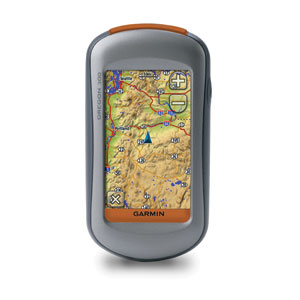
GPS / Navigation » Garmin Oregon 300/400t
Oregon 300 puts the great outdoors at your fingertips. This next-generation handheld features a rugged, touchscreen along with a built-in basemap with shaded relief, a high-sensitivity receiver, barometric altimeter, electronic compass, microSD™ card slot, picture viewer and more. Even exchange tracks, waypoints, routes and geocaches wirelessly between similar units.
Touch and Go
Oregon 300 leads the way with a tough, 3-inch diagonal, sunlight-readable, color, touchscreen display. Its easy-to-use interface means you’ll spend more time enjoying the outdoors and less time searching for information. Both durable and waterproof, Oregon 300 is built to withstand the elements. Bumps, dust, dirt, humidity and water are no match for this rugged navigator.
Product Link: https://buy.garmin.com/shop/shop.do?cID=145&pID=14903
Please rate this product: (no login required)


I’ve only had this GPS for about a week, so I will post a follow up review after I get some more miles with it. But, so far I’m like everything about this unit, except one thing:
It’s too hard to see the screen outdoors!
This could be a deal killer for me.
The software is great. Touch screen is fun to use and even works with bike gloves. Processing speed is seriously upgraded, so maps display quickly. Track log limitations (20 x 500 point “saved tracks”) are a thing of the past. This bad boy can handle up to 200 10,000 point tracks. That’s more than I’ll ever need for following even the most intricate bikepacking route.
But, so far I haven’t figured out an secrets to making the screen more visible when it’s on the handlebars and lighting conditions are variable. Sometimes I can rotate it on the bars and get it to show fairly decently. But sometimes it’s just impossible. Granted, my eyes suck, but the difference between the Oregon and, say, a VistaHCx or 60CSx is quite striking. I rode with both on my handlebars and rarely had trouble seeing even the smaller Vista’s screen, but the Oregon is a constant struggle.
The future looks good for Garmin handhelds, but I might skip the Oregon and Colorado (reported to be even harder to see outside than the Oregon) and wait for the next generation.
VistaHCx and 60CSx are the tried and true ones for now.
After using this GPS to navigate both familiar and unfamiliar terrain, I’m still on the fence as to whether the Oregon is better than the older generation of units.
I loved being able to upload as many tracks as I wanted in TopoFusion — no need to split or simplify down to 500 points. Just draw a new track and upload away. It was a little annoying to have to go to each track and do “show on map”, but this is a small price to pay for the additional capacity.
I spent three days bikepacking with this unit and experienced the whole range of light conditions — bright sun, clouds, overcast, rain, thunder and even night riding. Under low light reading the screen is no problem. This would be an awesome GPS in, say, Oregon (hmm, maybe that’s where the name comes from?!). But whenever the sun was even somewhat out it was a strain to see what I wanted, be it the map, a track I was following or just simple stats like current elevation or mileage covered.
Turning off the shaded relief helps a bunch, but still doesn’t bring it close to the visibility of current units.
I’m leaving for another trip with the potential for many navigation challenges and I’m afraid the Oregon may be staying home…
Can anyone uploaded garmin map format .IMG onto the Garmin Oregon 300 series? I have been able to load the map but can’t display it
Did you use Mapsource, or just copy the .IMG file directly? I’ve uploaded all sorts of maps, but always through Mapsource and it’s worked just fine.
FYI looks like Garmin might have started using touchscreens similar to the Dakota on the Oregon 450 and 550 models: http://gpstracklog.com/2010/04/garmin-oregon-450-review.html