Trip Reports » G.E.T. Part 4 (of 4) – more hike-a-bike and the Black Hills
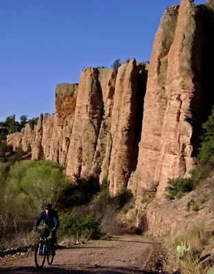
climbing away from the blue river
Despite being the weekend, Juan Miller Road was a very quiet place to be. A perfect morning on the bike. As usual, the lack of rough conditions was welcomed after yesterday’s tribulations on the Wildbunch Trail.
We pedaled and set our heads to 360 degree sweep mode.
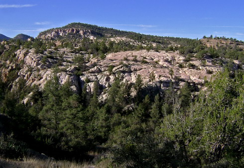
juan miller freeride anyone?
My head, especially, was intently scanning the terrain. I quickly realized we had discovered some prime mountain bike country. Solid rock was everywhere and my “line detector” was firing left and right.
The mesa in the above picture, in particular, called me. Kinda like Area52, but with trees. I found a rideable line (with gap move) onto the mesa, but time/food/water didn’t permit a further exploration.
I commented to Lee that it was almost a shame that the road we were riding was so well graded. It’d make a heck of a 4wd road, and reminded me of the rug road in many ways.
“Here you go, Scott! Steep, rocky! You can quit belly-aching about the road being too smooth now.”
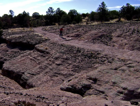
We turned onto the Pigeon trail / 4×4 road and I got what I was looking for. A few side slickrock moves were irresistible, but we soon climbed out of the cliff country and into more typical AZ terrain — loose volcanic rock.
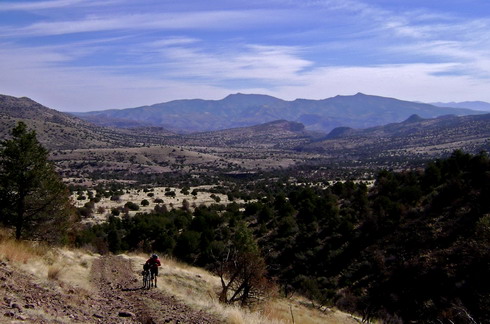
looking back towards maple peak from this vantage, it became obvious that the trail crosses at the highest possible place — for dozens of miles on either side
We prepared ourselves for another extended hiking session.
Not to be, after the above pitch it was 99% rideable up to Wing Tank. A solid 1500′ elevation gain.
We began deviating from the drawn line I had uploaded to my GPS. But a Brett flag showed us the way… for a while. Eventually a flag just led off into the trees, so we followed for a while.
“Guess I’ll get my gaiters out–this looks like some real bushwackin'” says Lee.
I headed due north for the GPS line and sure enough, there was an old 2 track heading in the correct direction. This led to a fascinating stone corral — fascinating that it was still standing since it wasn’t much more than a pile of rocks.
The next section of singletrack looked good, on paper. I had originally laid it out for my ’07 GET trip (laughs), but it has now become a part of the official GET route. Even a cursory inspection leads to words like “contouring” and “rideable” being conjured in one’s mind. Even a moderately detailed look still looks good — a lot better than some of the other terrain we had already covered.
So perhaps it was with high expectations that we hiked our bikes up the first hill away from the stone corral. A false lead led to McBride spring, a good source.
It’s true that we did find some sections that contoured, and many of those were rideable. But seemingly every up and every down was eroded, sloughed off, ludicrously rocky, or all of the above. Once again, it’s rare for a trail to be so unrideable downhill, so I think it was pretty unexpected.
The trail skirted the edge of some beautifully colored purple and red erosion channels. It made for some sketchy downhill walking. It was a relief to enter back into the forest.
And then it wasn’t a relief at all. The trail suddenly got quite overgrown — well into the “hold your bike” stage. Fighting through brush with a bike is slow going, and a lot of work. It really wasn’t very long, but even Lee started grumbling a bit.
I tried to break branches, but it was hard to accomplish anything without loppers.
I kept looking at the straight line distance to the next trail junction on my GPS. Getting 0.1 miles closer was an accomplishment. We were getting tired. It took 2 hours to cover the 2.5 miles from the stone corral. We were now at a decision point. The GPS showed a shorter trail going straight up and over the western ridge. It had a hefty climb though — up to 7400’+ feet. Our intended route stayed lower, but was ~5 miles with unknown trail conditions.
Despite being in the sun, we sat at the junction to eat a snack and decide our fate. It seemed pretty obvious — get back to the highway (Coronado Trail) ASAP. Downhill coasting on a nearly traffic-free highway sounded pretty attractive at this point.
One look above, though, didn’t look so attractive. We’d be pushing in the sun for well over an hour. One look ahead didn’t look so attractive either. We saw dead/burned brush — a good indicator of nasty overgrowth. If we’d seen ponderosa forests in either direction the choice would have been clear.
We both agreed to pushing up and over. But then a quick scan through on the GPS led to a discovery — part of the 5 miles ahead on our intended route was a road, and if memory served it was driveable. I rallied to stay the course, rationalizing that at least we’d be in the shade.
So, down (!!) we went on the Frye Trail, and initial indications were good.
Fresh lopper cuts, tread work. Yee-haaaaaaw!
I steep descent led to a creek bed and a flowy ramble down the canyon. An up and over rock move had me smiling. Regardless of how bad the rest was, I was happy with the choice.

contouring trail!!
Lee didn’t ride the up and over, and by contrast he was questioning the decision. Especially when the next climb started with a hiking pitch he looked longingly back at the other choice.
We weren’t in a ponderosa forest, but it was pretty darn close. Those “dead” trees were really maples (I think) and the soil content was high, rock content low. Hallelujah! Leaves crunching under tire, I made some bold climbing efforts.
I couldn’t get enough. Soon the trail did contour, for extended periods. Recent tread work, some awesome rock work. Quite a little gem and I felt incredibly fortunate just to be out there, experiencing it, riding it.
Meanwhile Lee was getting tired. This was the only part of the trip where I felt like I was consistently waiting for him. For a guy in his 50’s he’s sure a fit guy. But he was walking where I was burning energy pedaling, so it led to quite a difference in speed.
It just gave me more time to enjoy where I was and savor the fact that more singletrack remained.
A steep descent led to the 4wd road, right where the GPS said it was. Unobstructed descending followed, leading to the switchbacking Coronado Trail. We skipped a further 4wd descent (Chesser Gulch) favoring the smooth surface of highway 191.
191 — fast, smooth, beautiful — for a while. Not all downhill — a few 500’+ sucker hills in there, and the wind was powerful. Wind and open pit mines aren’t really a good combination. The dust was bad, but the scariest moment came when we were riding on a narrow ridge of tailing pile. The highway was relocated onto the tailings providing a perfect catalyst for high wind.
I’m a terrible estimate of wind speed, but it was challenging to stay upright and impossible to keep a straight line. Thankfully the one car that passed us in this stretch moved three lanes over into the other side’s passing lane to get around us.
We filled up once again at the cafe in Morenci, then explored a traffic-free alternate descent into Clifton. I remembered Brett had it marked on his maps for hikers, and the phonebook called the old railroad grade the “Greenlee County Healthy Lifestyles Trail.”
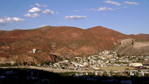
view of clifton, AZ from the greenlee county healthy lifestyles trail
We got turned around a few times in Morenci, eventually getting directions from some locals. A steep quad trail dropped us from the cemetery down to the railroad grade. We found an ancient sign near the bottom of the trail that indeed called it the Healthy Lifestyles Trail. Something tells me people in town are more into unhealthy lifestyles — this trail sure isn’t getting used.
We ate (again!) at the mexican place in Clifton before getting a room at the Rode Inn once again. The town was abuzz about a group of ATV riders that had ridden all the way from Tucson to Clifton with “very little pavement.” They were at the Rode Inn, so we had a nice chat about their route and the differences in our chosen modes of travel. They did do the rug road which was impressive.
It was funny how we heard about these guys from multiple people before meeting them. I doubt the town gets very excited about a thru-hiker or bike tourist passing through.
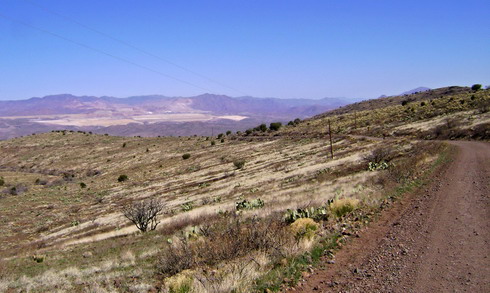
the byway
The next day was a straightforward ride, shuttling selves and bikes back to the Safford Regional Airport by way of the Black Hills backcountry byway. From riding the Great Divide Mountain Bike Route I know that the backcountry byway system usually means a great bike route.
It was. Smooth dirt, fantastic views, and only a handful of vehicles over 20+ miles. Plenty of climbing, too. I hit a mini-huck on a CCC built check-dam–just couldn’t resist. We pulled out our mp3 players and mine sure played some good tunes. More a function of my good mood than any particular song. After growing up listening to a walkman while mountain biking I’ve gradually gone away from it. The mp3 still comes along on any tour, mostly for use in the sleeping bag.
But on this section of road I was loving the tunes. I was loving that the trip was ‘over’ (conceptually) and yet it wasn’t. From the high points of the byway we could survey much of the terrain we had ridden, carried and fought through for the past five days. Creeks Bonita and Eagle were obvious lush drainages. The turtle mountains, the dusty mine, Mule Pass, the Blue Range hiding New Mexico.
Yeah, it was a good trip.