Desert Southwest (CO,AZ,UT,NM), Trip Reports » Gunnison Exploration
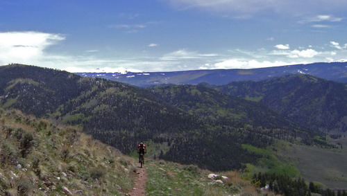
We’re working on an alternate route for the Colorado Trail. A major piece of the puzzle was getting from Gunnison (Hartman Rocks) to ~Los Pinos Pass.
So I spent a few hours with the Gunny BLM/Forest Map and TopoFusion quads and aerials. A few possible options presented themselves, but only on-the-ground recon would tell us if there was a viable route. Hopefully such a route would be fun to ride, too.
Hartman’s sure was fun. Riding fast and carving turns isn’t my number one attraction to mountain biking, but my constant grin made me believe otherwise for a time.
After an hour and a half of playing, we descended to South Beaver Creek. Pete picked up his bike and skated across the knee deep creek without much hesitation. Mike and I grinned at each other as we pulled off our shoes of and tip-toed across.
New country from here on out. We had several GPS lines to follow, and for a while, they worked out well. Sugar Creek was a wonderfully mellow climb on a grassed over double track. At some point after Vulcan, we got a little lost when the double track disappeared into a grove of aspens. There was an obvious road around it that fooled us until a check of the map revealed that it was a dead end.
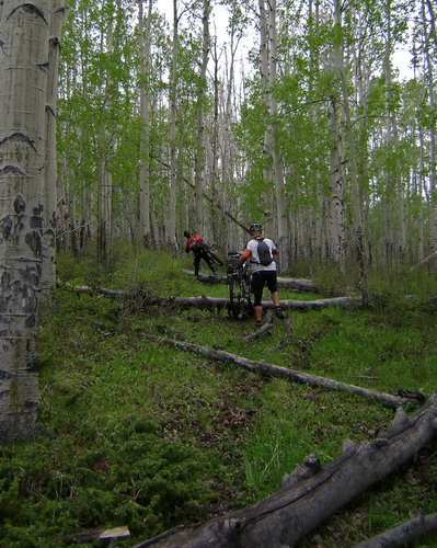
We found a small trace of the road making its way through the aspens.
As we gained elevation road conditions deteriorated. Mud started collecting on our bikes. Then the tiny specks of falling snow grew a bigger. It was not warm. But Mike had assured me that no storms can make it over the wall of the San Juan Mountains. It never percipitates in Gunnison, he says, despite the NWS forecast that read:
Southern mountains above 7500 feet will see precipitation in the form of snow with accumulating snow above 8000 feet. Expect showers to persist into the afternoon with trough axis swinging through the region during the latter part of the day. As this occurs…area will likely see transition to more cellular convective processes but sufficiently numerous to yield widespread snow accumulations in the San Juan and portions of the west Elk and sawatch ranges.
It was getting late as we climbed to 10,000 feet. None of us relished the thought of starting a 20 degree night wet, and the snow was showing no sign of letting up. I was happy that Mike and Pete, veterans of the Alaska snow races, seemed more concerned about getting somewhere warm than I did. Once I lay out a GPS line I want to see where it goes — merging mapping with reality. But we sat at 10k, and our route climbed (steeply) through more snow. Unless the ensuing descent was a major, graded, gravel road (it wasn’t) we would be foolish to try to descend it.
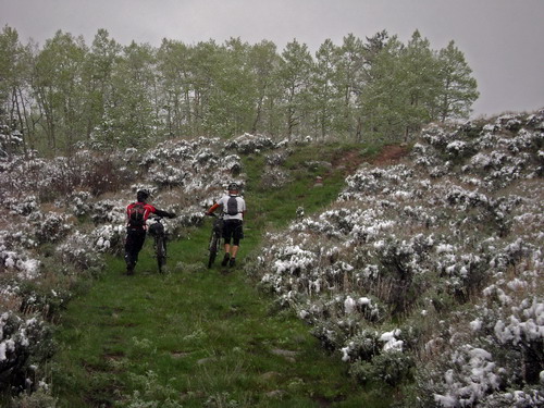
Hikin’ and slidin’ to 10,000 feet
So we turned off the route at 6pm and descended towards to ‘town’ of Powderhorn. It was an exciting descent, snow collecting on my brow as I struggled to see/read the wet trail. Thank goodness for disc brakes. 1800 feet of descending later, we were much colder, and still looking longingly at any sort of structure, no matter how derelict.
A patio at the school looked tempting, except for the obvious “No camping” sign that had Mike laughing out loud. It was brand new and seemed like they put it up just for us. Otherwise there wasn’t much at Powderhorn. We milled around for a bit, before I pulled out the map and realized our best option at this point was to turn tail, put our heads down and pedal back to Gunny. It was unknown mileage and unknown climbing, but it was mostly paved.
The highway climbed more than expected, which was fine. I found a comfortable spin and grinded it out, which warmed me up considerably. What goes up must come down, unfortunately, and I froze myself nice ‘n good on the descent. Mike and Pete were less affected by it, so they waited as I walked to regain feeling in my feet. It came back soon enough.
At Highway 50 the sun had set, so we stuck together and spun out the last 9 paved miles into town. The Water Wheel Inn provided roof, shower and hot chocolate.
It’s winter in Colorado.
Not so much the next day. Blue skies and spring time temps. We retrieved the cars at Hartman and drove back to Powderhorn to resume exploration, still with camping gear. We climbed towards Huntsman Mesa, en route to rejoin our snow descent route. But there was another way to get us up there, and it piqued my interest. I gave Mike and Pete plenty of opportunity to take the known/gradual route back to 10,000. But in the end they let me decide.
We went the new way.
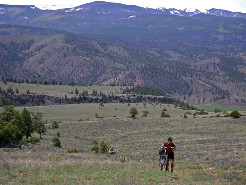
They should have known better. Hike-a-bike.
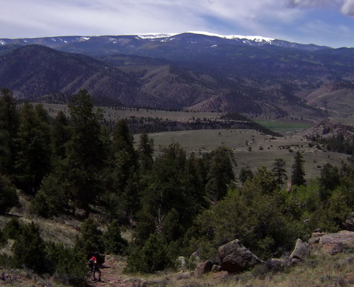
Beautiful day, though, and I think we were just happy to be out. Mike was having stomach troubles, so Pete and I waited and discussed a few options. The last part of yesterday’s route didn’t work out, so we decided to split up, with Mike backtracking on a loop back to Midway/Vulcan, and Pete and I continuing on, hopefully making it through to Cathedral.
There was a large stretch of “white” on the map we needed to cross. White = dreaded “private property.” There were no locked gates, according to the map, but that doesn’t mean it’s OK to pass through. I write and say this all the time, but there was only one way to find out.
We pushed on through the hike-a-bike, bushwhacking a short section of forest to an old cabin and another steep road. At Huntsman Mesa we found a maze of bumpy roads, which we continued climbing on. Keep in mind, Pete was rolling a singlespeed through the whole trip. In classic Pete form, he was putting his new bike together at 1am the morning before driving to Gunnison. I guess the frame builder sent the wrong dropouts, so he had to run it as a singlespeed. He already had some serious miles on his legs (KTR out ‘n back), yet the guy was riding strong throughout, in very unfriendly singlespeed terrain.
We ran into more hike-a-bike where we rejoined the GPS line at our bailout point. Then my suspicions were confirmed — the extremely steep descent to “Road Beaver Creek” was muddy/slick enough today. I could only imagine what it would have been like last night.
We made a few unplanned deviations from the GPS line (aerial photos are obviously old here) but found our way to the big climb back to Summit Park. It was a beautiful little two track. Lush canyon, lots ‘o wildlife, good climbing. Pete and I chatted about his upcoming Great Divide attempt and the whole range of multi-day races. It was pretty cool to be able to ride with him.
We crossed the creek and continued on the only road present — but I quickly saw it was deviating from the GPS line. I was sure I hadn’t missed a road, so we kept climbing. Eventually we met a dead end and I realized the ~6 foot high trees around us meant we were in a logging area. I had seen these roads on the aerials and knew they didn’t go anywhere — at least not that the photos indicate. It was worth climbing up there to be sure they hadn’t been extended since the photos were taken and were indeed dead.
So we rolled back down to the creek and searched out the missed road. Pete hopped a fence and looked on the hillside while I searched near the logging road cut. I found an opening on one fence with a faint trail that led to another fence. Ahead I could barely make out an overgrown, but cut, path just wide enough to be a road.
We quickly lost this road, running into a large boulder field. Backtracking I kept looking over my shoulder for something we had missed. Sure enough, there was a tiny little cut into the hillside that led around the lower edge of the boulder field.
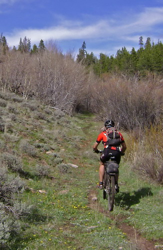
Doubletrack that rides like singletrack
What followed was surprisingly rideable and clear of trees/brush. Amazing considering how invisible it was at the start.
Sadly, 0.1 miles from the top, we met with No Trespassing signs. This was the crux of the route, and we were shut out. Nothing to do but descend back down to Powderhorn. Fortunately all our climbing paid huge dividends. It always sucks to backtrack, but I remember loads of coasting and smiling. Jumps. Creek crossings. Coasting and smiling.
Mike met a similar fate — mucho gates and private land near Midway. It’s back to the drawing board.
We camped at Hartman’s that night. Listening to Mike and Pete reminisce about the ridiculously epic battle that was GDR ’04 was highly entertaining. I was on the route, with Paula, during that race, and following it intently. I don’t know if there will ever be a GDR, or any other multi-day race, or any race period, as good as that one.
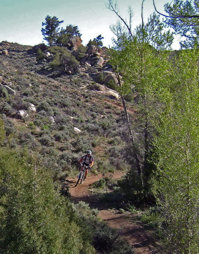
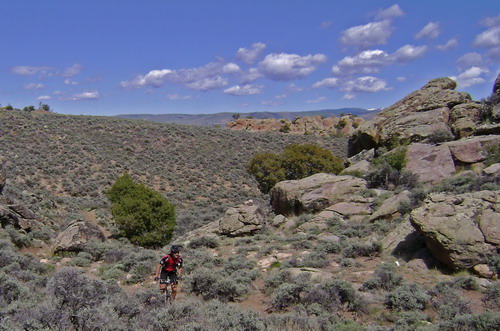
We finished up the trip with 3.5 hours of unloaded singletrack bliss courtesy of Mike’s knowledge of the area. Plenty to do there and plenty to like. If you’re into that kind of thing…
As Mike loves to say.
On the way back I stopped to talk to two Divide riders (the divide route is US 50 for ~15 miles from Doyleville to Sargents). They had started in Mexico on April 23rd — way early. They had some good stories, including a cold snowy night out when we had bailed back to Gunny.
Sounds like a great one – and the exploration must continue. It sounds like you dissappointed to ride fun singletrack unloaded at the end of the trip. You have a sickness, but the cure is coming shortly.