Desert Southwest (CO,AZ,UT,NM), Trip Reports » Lost in Lost Park
Georgia Pass – 11,600’ Elevation
Day 1 – 9pm
August 11, 2009
12 Miles
The sun has set and the last alpenglow on Mount Guyot has faded off, the mountains begin to brood as darkness settles over the continental divide. I flip on my handlebar light and continue peddling upward into the last gasp of tree line as the temperature starts to drop. I need to find a campsite.
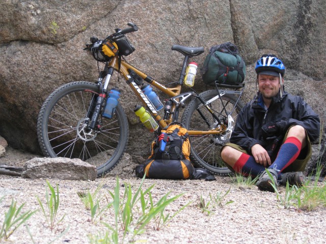
Wendy dropped me at Kenosha Pass at 6pm on a beautiful evening and we parted ways as she drove back home and I headed west toward Georgia Pass. There were scattered clouds and the temperature was short-sleeve weather…I knew it would be a perfect night. On my bike with me I had the following: hammock, sleeping bag, stove, freeze-dried meals, oatmeal, rain gear, bike tools and spare parts, extra clothing, and all the accessories (camera, gps, maps, sunscreen, etc) My bikepacking kit felt pretty good, a little heavy in the rear but nothing I couldn’t handle. The extra weight on the bike actually seemed to make it handle a little smoother. This would not be the case on future hike-a-bike situations!
I set up my hammock in a small copse of trees right at tree line about one mile below Georgia Pass in darkness. I put on my extra layers, cook my dinner, eat my dinner, organize my stuff and then sit back and realize how quiet it is. Freaky quiet. I look around suspiciously for a few minutes getting my resolve up. It has been a long time since a solo overnight in the wilderness. Then the heavens open up and the stars literally burst open. They shed enough light without any moon at this point to see my way around. I walk up the trail a bit to get a glimpse of Mount Guyot and soak in the moment. What a place to be by yourself in the dark on a perfect night at almost 12,000 feet in the Colorado high country!
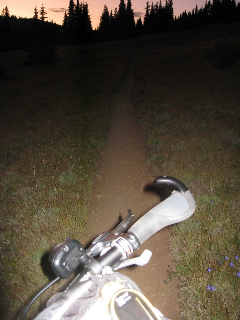
Sunset high on Georgia Pass
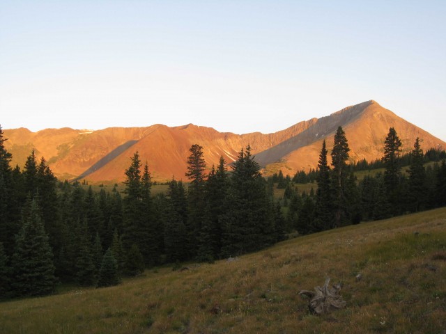
Sunrise on Mount Guyot
Georgia Pass – 11,600’ Elevation
Day 2 – 630am
August 12, 2009
65 Miles
It is cold. Really cold! I had planned to get up and make a cup of coffee while I watched the sun light up Mount Guyot, but the temperature has forced me to put on all the clothes I have brought including rain gear. I mount up and ride to the Pass in order to warm up, which works very well, and soon I am sweating under all the layers. At the Pass I shed my rain gear and let the un-wicked moisture dry out from inside while I make a hot cup of coffee. It is a glorious place to have a cup of coffee for sunrise. I hike up to a high point to try and get a signal on my cell phone to call Wendy. I wish she was here for this, she would enjoy it. But I get no reception and all I get is a sighting of some mountain goats down on the end of the Old Georgia Pass road.
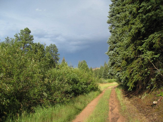
I mount up again and start my descent down the Colorado Trail on the north side of the Pass; it is some great buffed-out singletrack. At about the 3 mile mark from the Pass I begin riding the old flume trails above the South Fork of the Swan River. Immediately there is a nasty steep detour around a washed out trestle and I am pushing my loaded down bike up some seriously steep grades, but it is a short detour and I am back on the bike soon enough only to run into some deadfall…off the bike to haul it over the deadfall and then back on again. This is the trend for the next 15 miles or so as I weave in and out of the South Fork of the Swan River valley and French Gulch, where I pick up the French Gulch Road into Breckenridge. The old flume trails are some interesting piece of history. It is hard to imagine the effort put into making those trails, and fun to think about what the old loggers would think about us riding our bikes on them nowadays.
Down in Breck, I buy myself a cycling cap to keep the sun out of my eyes because it is a beautiful cloudless day and then I get some lunch. At the Conoco I load up on two days worth of food: beef jerky, gummy bears, peanuts, Fig Newton’s and a Gatorade to pour down my throat. I am only making the pack heavier for the 10 mile climb up Boreas Pass, but it is a gentle grade and I make it to the top by 3pm. I chat with a hiker at the top who snaps a picture for me and then it is off the other side heading for the Gold Dust Trail. This trail is flat out fun and I fly down to Como where I cross Hwy-285 and head out into the flat empty nothingness of South Park on Elkhorn Road. This is the Great Divide route and I picture myself heading all the way to Antelope Wells in New Mexico. That only lasts for a moment as I turn north onto CR-32 and head into some strange country. Brown, angular heaps of rock stick out from the plains and catch the late day sun. I am in a covenant controlled community but there are so few houses that it feels odd, and all the dirt roads are named: Benton Circle, Travois Road, Mustang Road. But where are all the people and houses? A lonely place to live.
At around 6pm I pop onto the Tarryall Road – CR 77 – at Stage Stop Road and run into the Stage Stop Saloon. The sign out front says, ‘Food, Ice, Groceries, Drink’, and I think: ‘ah, perfect, I need a cold drink and some fresh snacks’. So I pull up, drop the bike and walk inside and realize it is just a bar, an old bar, an old country bar complete with rickety slamming door and creaky floorboards inside. There is no one inside, and I look around for a while trying to figure out what to do. I decide to use the bathroom. As I wash my hands in the sink, I see mouse turds in the sink and next thing I know a soaking wet mouse runs up out of the drain into the sink! Startled to say the least, I turn off the faucet and walk back out into the bar. This time there is a bartender and I tell him he’s got a mouse in the sink, and he tells me he’s been here for fifteen years and never heard such a thing. He goes in after it and comes out with a bite on his thumb. For his second attempt he brings a cat from out behind the bar and goes into the bathroom. I never find out how the cat fares. After a while I realize that nobody is going to ask what I want. At this point there is one guy at the bar and the bartender and his wife behind the bar. So I get a cold draft PBR and a bag of chips and slam them both. Back outside I chuckle at the quirkiness of this place, and climb back on my bike with a little buzz. I head up CR-77 to CR-39/Rock Creek Road and head north back into the Pike National Forest. It is 7pm and sunny and extraordinarily beautiful as the sun gets low. I try Wendy again on the cell, and this time I reach her and tell her my mouse/bar story which I think is a pretty good one. We have a nice chat and then I head north on Rock Creek Road looking for camp. At the 65 mile mark for the day I find a nice Aspen grove and string the hammock up between two good ones. Another nice camp on another beautiful day. The freeze-dried beef stew for dinner is fantastic!
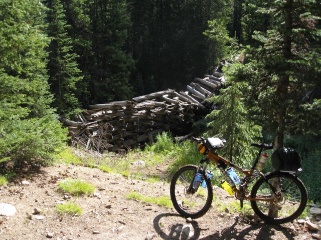
old trestle bridge on flume trails above Breckenridge
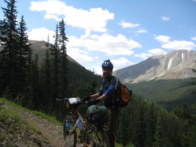
french gulch flume trail
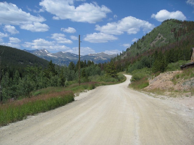
French Gulch Road
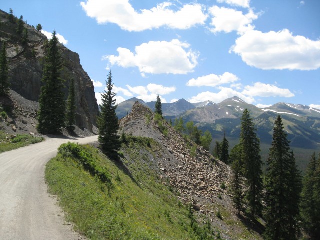
Boreas Pass Road
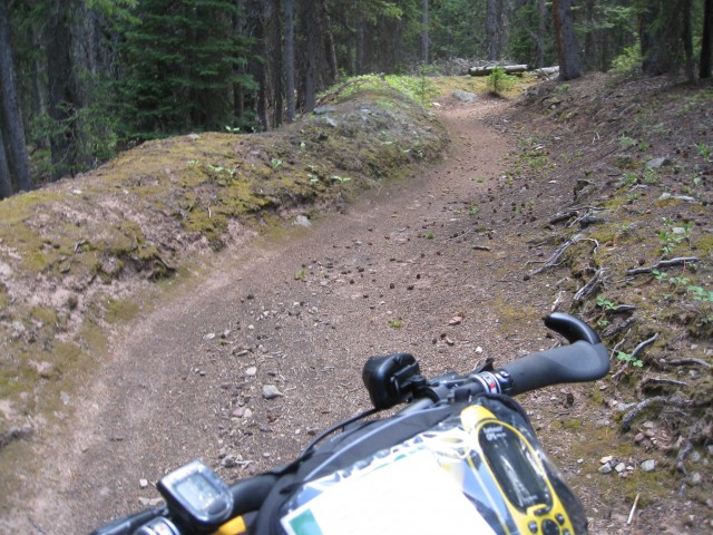
Flume trail on Gold Dust
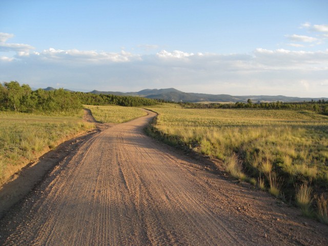
Sunset on Rock Creek Road
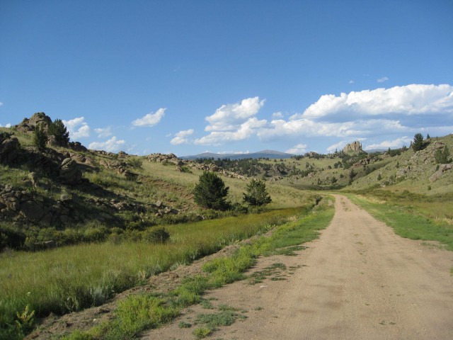
Lonely road somewhere in....
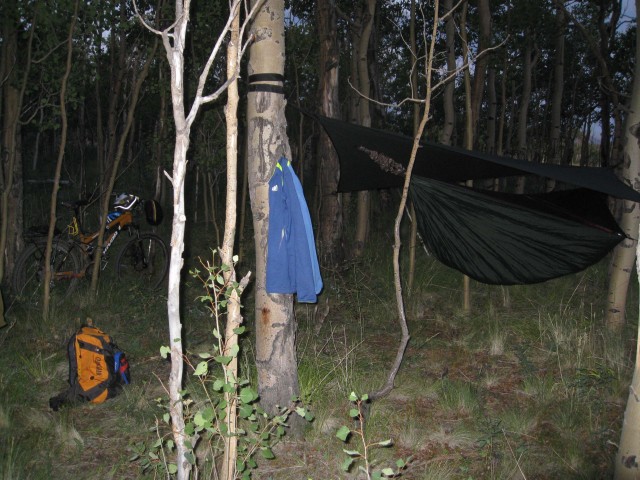
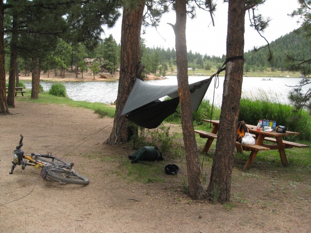
The Hennessey Hammock in action...
Road 131, Pike National Forest
Day 3 – 8am
August 13, 2009
45 Miles
I wake up a little late this day and I am sore. I have cramps in my quads and calves and feel significantly older than I did yesterday. There is widespread cloud cover and the general feeling that it is not going to break. I make some coffee and oatmeal at a ridiculously large fire ring, look over the map and then pack up my gear. Climbing back on the bike is a good feeling and I get rejuvenated as I continue heading north on Rock Creek Road for Lost Park Road. This is national forest land, dispersed camping land, and there are RV’s tucked into the trees off unnamed roads. There is little to no traffic. I gain Lost Park Road and begin the climb up toward Long Gulch. I have no water and need to filter some so I pull off and look down at Rock Creek and realize it is stagnant and covered with swarms of bugs. Not looking good. At that moment an older couple from Boulder pulls up in a Subaru Forester and the women gets out to stretch. I ask her if she thinks this water looks good to drink (a stupid question, knowing myself that it looks horrid) and she immediately says: ‘oh no…we have some water, here take some, we are heading home to Boulder and plenty left over’. Thank you couple from Boulder in the Subaru Forester that filled up five bottles with fresh cold water!
I regain the Colorado Trail at the Long Gulch trailhead and begin the 2 mile climb up to the beginning of a magical stretch of singletrack through a grand meadow in the North Fork of Lost Creek. And it just keeps going and going, down and down, beautiful twisting smooth singletrack. The weather begins to turn on me at about mile 6 or 7 in the meadow and it is exposed and open and I need to get out of this meadow. I finally do so at the North Fork trailhead, and climb up a rutted road back to Lost Park Road. And at this point begins the Nate Stultz trail, the bane of my trip.
The Nate Stulz trail connects Lost Park Road with CR 77 and is one of the few ways up and over the Tarryall Mountains at this point between the Lost Creek Wilderness and Kenosha Pass. I gain the trail and begin climbing up Monkey Creek into another meadow and it is apparent immediately that no one ever uses the Nate Stulz trail…ever! I have a friends GPS track that I am thankfully following otherwise I would have been lost. The weather continues to worsen, but no rain, just dark skies and I am back in another meadow…exposed…open. And this darn trail keeps petering out. Finally out of the meadow the trail turns to an old road and for me it becomes a straight pusher, up and up and up. I reach an old road, cross it and find a great overhanging rock to take shelter under. I brew some coffee, put on my rain gear and expect the rain to come crashing down and the lighting and thunder to strike and roll…but nothing comes. It just stays dark and I can’t wait forever. So I pack up and continue on under oppressive skies. Climbing now ever higher and thinking this is the wrong way to be going in this weather. At the top is High Park, yet another meadow at around 11,000 feet and again I am exposed to the dark purple clouds that don’t seem that far away. I try to cover ground but the Nate Stulz conspires against me with deadfall, and disappearing trails. Finally I get through the meadow to a steep descent on a loose, rocky unused trail and carefully weave my way down. At the bottom near Gooseberry Creek I am supposed to head left across the creek to the Cabin Springs Road trailhead. But there is no heading left, the trail keeps taking me the wrong way, my map is off. So I begin a 1-hour ordeal of a bushwhack through thick alder along the stream, manage to fall in the stream, the bike keeps getting horribly caught up in the underbrush and I emerge on the other side with a steep hillside in front of me. I push up the crest and find the damn trail that I couldn’t find before. Finally I get to the trailhead, say a good riddance, and fly down Cabin Springs Road back to CR-77/Tarryall road.
All this time the skies have just been dark and forbidding but they haven’t done anything. I fly down on smooth pavement to the Tarryall Reservoir and find a nice picnic shelter with a bench that I take refuge in again. I spend about an hour looking over the lake, watching people fish from canoes, eat some food, apply some chain lube, and wait for the weather to move off. I want to talk with Wendy, but I have no service. So I pack up and ride off. I get to the Ute Trail River Ranch fifteen minutes before they close their General Store and I stock up on Starbucks Cappuccino drinks, Gatorade, M&M’s, and Goldfish and have a nice chat with the owners who tell me about ‘the European bikers who come through expecting to ride the whole Colorado Trail, but get chewed up by Matakut Road and decide to turn back at the Ranch’. Matakut Road is of course my route home.
I make it to Twin Eagles campground and find a nice spot on a hillside above Tarryall Creek. I get Wendy on the cell surprisingly and chat for a while. Tonight it is freeze-dried Chicken and Rice and man is it tasty!
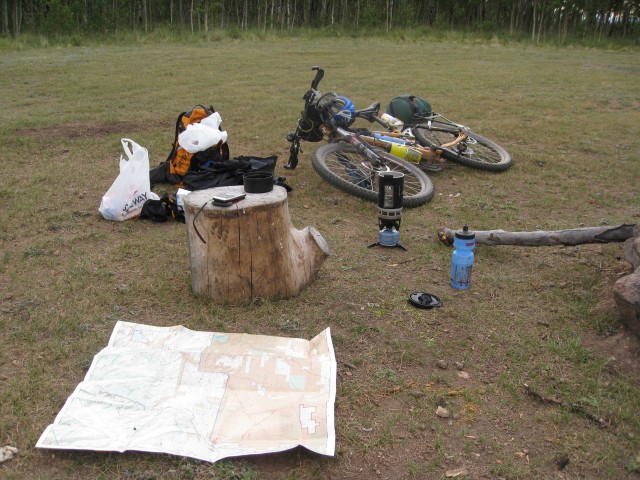
Morning planning
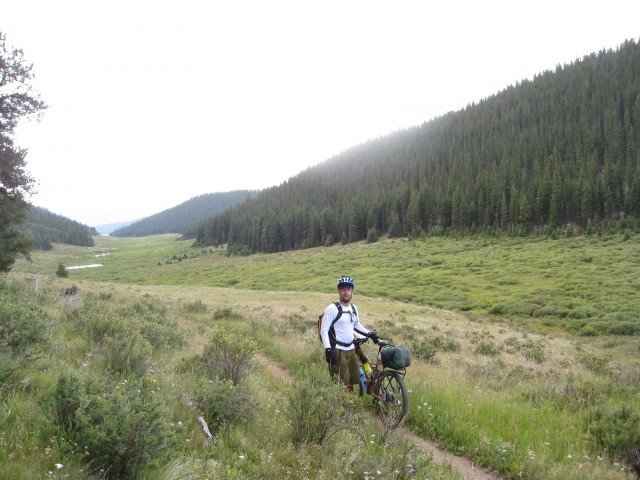
Colorado Trail meadow
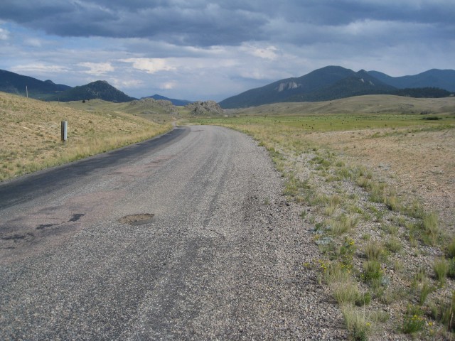
Tarryall Road
Twin Eagles Campground
Day 4 – 530am
August 14, 2009
55 Miles
I wake early to light rain on my hammock rain fly, and say a silent curse. All day yesterday under purple skies and no rain, and now rain in the morning, so rare in Colorado to have rain in the morning. But ah well, today is my last day on the road…I set up a meeting point with Wendy at Buffalo Creek for 630pm. Plenty of time. The rain lifts as I head out to CR-77 and I cruise into Tarryall before sun-up, it is a lonely place and I wonder what these people do that live there. I make it to Matakut Road/FS-211 in 30 minutes and turn left onto the dirt road. I shed my rain gear and begin a steady climb up into the Hayman Burn area. There are numerous signs warning of flash floods, falling trees, debris in the road, blocked trails, and the need to climb to safety during floods. The sky of course is just screaming rain again, a dark solid mass of clouds in all directions…no sign of breaking up with the dawn. I find a nice spot for some breakfast, drink some coffee, eat some oatmeal, and watch as the wind begins to pick up and I can see the undersides of the leaves…never a good sign. So I mount up and head out into the hugely exposed area of the Hayman burn area: 138,000 acres of human caused burn. There are still many trees standing but they are dead and black and eerie looking. You can see for tens upon tens of miles and it is all burned and dead. It is a bit spooky and under dark skies it is even worse. I keep peddling expecting rain but it never comes and I pull into the Goose Creek campground before 9am. I get some fresh water from Goose Creek, use the bathroom, and take a nice breather. At this point I realize I am way ahead of schedule and will have no problem reaching Wendy in Buff creek by 630 barring any bike issues or major malfunctions. So I slow up and take my time to Wellington Lake, where I get a campsite for six bucks and set up my hammock for a nice afternoon of relaxing.
I get kicked out by some campers who have had the site reserved since February (yes, since February…that is some forward planning) – shouldn’t a reserved site have a reserved sign on it? Oh well, time to move along anyway. But of course as soon as I get packed up, around 4pm, the rain decides to come. So I move out into the Buffalo Creek area under rain and seriously dark skies. But again, luck is with me and I miss the worst of it. Peddling down Buffalo Creek Road, the storms have moved east, and the sun comes out in the west. It is a beautiful time of evening as I cruise down my home turf.
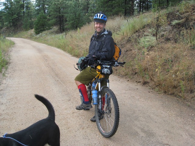
As I get close to the parking area, I am hoping Wendy will be there, but I am a little early…but sure enough she is there walking up the road with our dog and it is a great site. We have a little reunion and she laughs at my knee high socks. But I’ll tell you right now that the knee high socks are a seriously good piece of gear to have!
All in all, a really fabulous tour through some little visited country. I will wait a while, but I’ll be back to get Lost in Lost Park again some day.
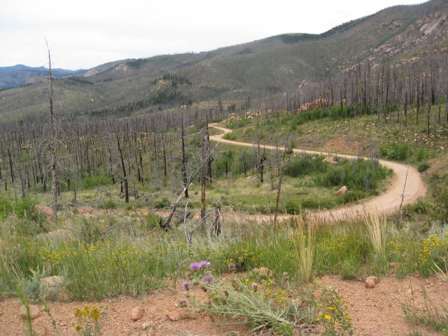
Matakat Road
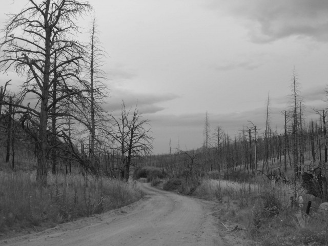
Hayman Burn area
Vital stats:
Total mileage: 177
Total climbing elevation: 25,000+
Great journal of your trip Nick and I really enjoyed the pictures. Maybe sometime we can get together for a bike camping trip. I’d like that alot. Not many people, that I know, who like to do that kind of thing.
Excellent report and a solid adventure. Sounds like I can cross the Nate Stultz trail off the ‘todo’ list.
Somebody has to figure these kind of things out… the hard way. Thanks for the post.
Nick – nice writing! Thanks for posting this. I liked your setup too – water bottles off the fork and steam: did you use a hydration pack at all?
Hey, no…no hydration pack, tried to get as much weight off my back as possible. The water bottle mounts I used were Elite universal clamps…which worked ok, some slippage on them now after about a year of heavy use. thanks for reading!
Nick,
Nice write up, thats what Bikepacking is all about! Great pics.
hey, nice trip I live in Woodland Park south of where you were at, terrain is pretty similar. The Hayman starts just 17ish miles north of us, Youre right it is really creepy.
you have beautiful pics, I like it
Nice write up Nic! Someday we will have to do N. Stultz when you’re not loaded down w/gear. It might change your opinion(maybe not).